
Area 386 km² | Administrative divisions 1 ŭp, 26 ri | |
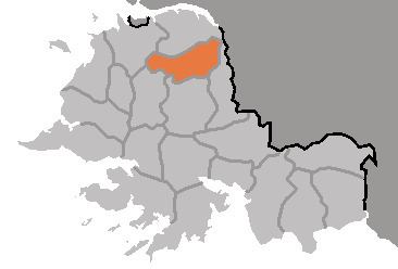 | ||
Anak County is a county in South Hwanghae province, North Korea.
Contents
- Map of Anak South Hwanghae North Korea
- Geography
- History
- Transportation
- Administrative Divisions
- References
Map of Anak, South Hwanghae, North Korea
Geography
Anak is bordered to the east by Chaeryŏng, to the south by Sinch'ŏn, to the west by Samch'ŏn and Ŭnryul and to the north by Ŭnch'ŏn. Anak is generally flat, though it becomes more mountainous to the west. The highest point is Mt. Kuwŏl, at 954 meters.
Anak is very famous for its Koguryo-era tombs, the most famous of which is Anak Tomb No. 3. All of them are registered as part of the Complex of Koguryo Tombs UNESCO World Heritage Site. The county is also home to the famous Wŏljŏngsa Buddhist temple, founded in 846.
History
Anak County was first conquered by the kingdom of Koguryo in 757. Koryo dynasty named the area occupied by Sinch'ŏn as Sinju. Chaeryŏng was briefly merged into the newly formed Hwanghae District in 1895 during an experimental redistricting, but was restored to its previous form in 1896. The county's current form was settled in the 1952 redistricting changes, in which its northern part was split to form Ŭnch'ŏn county.
Transportation
The county is accessible only by road.
Administrative Divisions
The county is divided into one town (ŭp) and 26 villages (ri).