
Airport type Public Elevation AMSL 241 ft / 73 m 3,015 919 Phone +1 360-293-3134 | 18/36 3,015 Elevation 73 m Owner Port of Anacortes | |
 | ||
Website PortOfAnacortes.com/... Address 4000 Airport Rd, Anacortes, WA 98221, USA Similar Anacortes Ferry Terminal, Anacortes Chamber of Comm, Skagit Regional Airport‑Bvs, Oakes Ave and Harborview | ||
Windy flight to anacortes airport in a cessna skycatcher
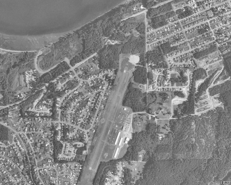
Anacortes Airport (IATA: OTS, FAA LID: 74S) is a public use airport located two nautical miles (3.7 km) west of the central business district of Anacortes, a city in Skagit County, Washington, United States. It is owned by the Port of Anacortes.
Contents
- Windy flight to anacortes airport in a cessna skycatcher
- Anacortes airport
- Facilities and aircraft
- References
Anacortes airport
Facilities and aircraft
Anacortes Airport covers an area of 120 acres (49 ha) at an elevation of 241 feet (73 m) above mean sea level. It has one runway designated 18/36 with an asphalt surface measuring 3,015 by 60 feet (919 x 18 m).
For the 12-month period ending May 30, 2008, the airport had 14,500 aircraft operations, an average of 39 per day: 79% general aviation and 21% air taxi. At that time there were 43 aircraft based at this airport: 95% single-engine and 5% multi-engine.
References
Anacortes Airport Wikipedia(Text) CC BY-SA