
Population 1.514 million (2011) | Website gujaratindia.com | |
 | ||
Points of interest Nagnath Temple, Dargah Shareef Of Sayyed P, Chanch Bungalow, Kamnath Mahadev Mandir, Mitiyala Wildlife Sanctuary | ||
Amreli district (Gujarati: અમરેલી જિલ્લો) is one of the 33 administrative districts of the state of Gujarat in western India. The district headquarters are located at Amreli. The district occupies an area of 6,760 km² and has a population of 1,513,614 of which 22.45% were urban (as of 2011). From Amreli district maximum number of NRI in USA from Saurashtra. Amreli is land of Yogiji Maharaj, Danbapu, Sage Muldas, Sage Bhojalrambapa, Sage Muktanand Swami, Magician K.Lal, Zaverchand Megahani's place (Bagasara), Dr. Jivaraj Mehata etc. Amreli covers Gir National forest sanctuary area. Now it is developing as a Hub of Education.
Contents
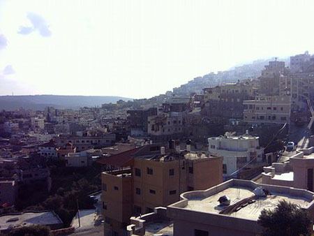
- Map of Amreli Gujarat
- Origin of name
- History
- Geography
- Economy
- Divisions
- Demographics
- Culture
- Notable personalities
- References
Map of Amreli, Gujarat
Origin of name
Amreli district name derives its name from the town of Amreli, which is the headquarters of the district. It is believed that during the year 534 AD, Amreli existed as a city place with name Anumanji. After that the name was Amlik and then Amravati. The ancient Sanskrit name of Amreli was Amarvalli.
History
Initially, Amreli was a small village with an ancient history, and part of various kingdoms and empires established in the area. It shot into prominence, turning from village to town, when the Marathas began acquiring territory and establishing their reign over the region in 1780s. Besides levying taxes on the other rulers of the Kathiawar Peninsula, the Gaekwads also acquired their own territory and chose Amreli as the headquarters for their "Kathewad Pranth", which included Dwarka mandal. Vithalrao Devaji was appointed the Diwan (1801–1820), and during this period, Amreli grew and prospered. Vithalrao Devaji converted much of the adjoining forest land into farm land to realise revenue and also built the Nagnath Mahadev temple. Later in 1886, under the Gaikwad regime, compulsory and free education policy was adopted in Amreli for the first time. From 18th century to 1959, Dwarika and Okhamandal was part of Gaikwad - Amreli state but after 1959, those two cities were merged with Jamnagar district.
During the British raj, the Rajput Gaekwad dynasty organised its Baroda State into four administrative prants (equivalent to British Districts), namely Baroda itself, Kadi (the largest), Navsari and Amreli, the smallest.
After independence the district became the part of Bombay State and a separate district in Gujarat State after the bifurcation of Bombay State.
Geography
Amreli has variety of lands like Medium black, loamy, sandy, rocky inferior and saline.
Economy
Amreli district is industrially backward area. There are some small industries like oil mills spread over the district. Gem cutting and polishing industries are located in Babra. Savar Kundla taluka is famous for its weighing materials and machines all over India. Fisheries is rendering a part to districts credit in Rajula and Jafrabad talukas. Amreli district has 6 GIDC (Gujarat Industrial Development Centres) industrial estates of State Government and 1 from District Panchayat. Among them there are 2 GIDC in Babra.District has 4822 Small Scale Industries and 5 Medium Scale Industries in which Rs.4947.35 lakh is invested. 16,640 employments are generated through this industrial centres.
Economy of Amreli district depends upon agriculture.Babra is famous for Ginning Industry in the nation. There are more than 50 Ginning and Pressing Factories are running in Babra and near. Diamond industry is developed well here. In Bagasara city gold plating units and in Savar Kundla weighing machine for diamond are famous. Pipavav, Jafrabad and Victor ports are in the district. Agro-based industries are well developed in the district. Mainly groundnut, cotton, sesame, bajri, wheet and grams are grown therein.
There are major industries in the district : most UltraTech Cement Co. Ltd., Kovaya, Tal : Rajula. Narmada Cement Co. Ltd., Tal. Jafrabad. Metadist Co.Ltd., Tal.Rajula Dharamshi Morarji Chemicals Ltd. Zar, Tal. Dhari. GHC Ltd., Tal. Rajula, Jafrabad
Divisions
The district comprises 11 talukas.
Demographics
According to the 2011 census Amreli district has a population of 1,513,614, roughly equal to the nation of Gabon or the US state of Hawaii. This gives it a ranking of 329th in India (out of a total of 640). The district has a population density of 205 inhabitants per square kilometre (530/sq mi) . Its population growth rate over the decade 2001-2011 was 8.59%. Amreli has a sex ratio of 964 females for every 1000 males, and a literacy rate of 74.49%.
Culture
The most popular temples in the city of Amreli are Nagnath Temple, Gayatri Temple and Shreenathji Haveli. The other tourist places in Amreli district are Tulshishyam, Una, Sarkeshvar Mahadev, Balana(Jafarabad), Delvada, Holi-Dharin Nana Visavadar, Vakuni-Dhar, Hanuman Gada, Satadhar, Galadhara-Khodiyar Temple and Khodiyar dam and Kankai.