
Peak Djebel Ksel Length 130 km (81 mi) ENE/WSW Area 7,710 km2 | Elevation 2,008 m (6,588 ft) Width 40 km (25 mi) NNW/SSE | |
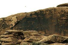 | ||
The Amour Range (Arabic: جبل العمور, French: Djebel Amour) is a mountain range in Algeria, part of the Saharan Atlas of the Atlas Mountain System.
Contents
Map of Djebel Amour, Algeria
Geography
It is located in the central area of the Saharan Atlas, with the Ksour Range in the western and the Ouled-Naïl Range in the eastern end.
The town of Aflou, one of the highest municipalities in Algeria and also one of the coldest, is located in the range at an elevation of 1,426 m. There are about 35,000 people living in the area of the Amour Range. In Taouïala (تاوياله), located 35 km to the southeast of Aflou, there is an ecotouristic village.
Peaks
The mountains of the Amour Range have altitudes averaging between 1,400 and 2000 m. The highest summit of the range is 2,008 m high Djebel Ksel. Other notable peaks are: