
Constituted January 17, 1987 Time zone EST (UTC−5) Area 435.1 km² Province Québec Local time Tuesday 6:47 PM | Settled 1910 Elevation 310.00 m (1,017.06 ft) Postal code(s) J9T Population 12,671 (2011) Area code Area codes 819 and 873 | |
 | ||
Weather 1°C, Wind S at 16 km/h, 91% Humidity | ||
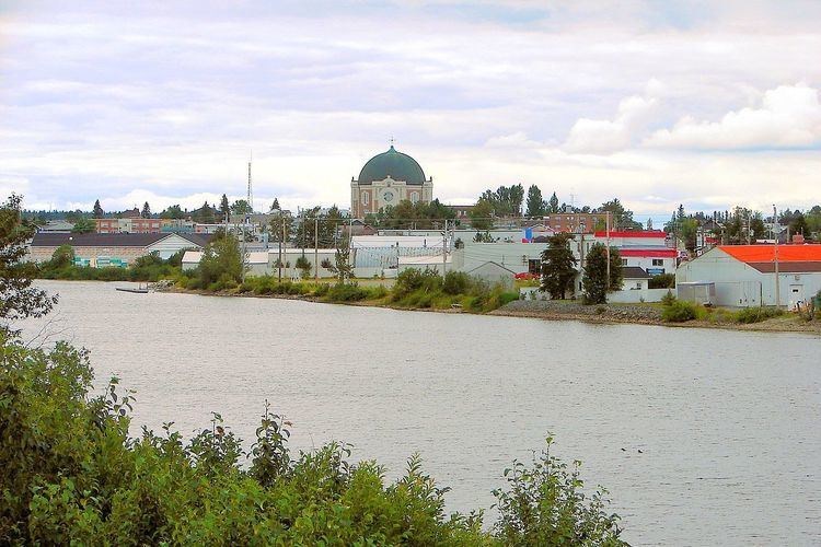
Amos is a town in northwestern Quebec, Canada, on the Harricana River. It is the seat of Abitibi Regional County Municipality.
Contents
Map of Amos, QC, Canada
Amos is the main town on the Harricana River, and the smallest of the three primary towns — after Rouyn-Noranda and Val-d'Or — in the Abitibi-Témiscamingue region of Quebec. Its main resources are spring water, gold and wood products, including paper. In 2012, Quebec Lithium Corp. re-opened Canada's first lithium mine, which had operated as an underground mine from 1955–65. They are planning to carve an open pit mine over pegmatite dikes. (The pegmatite is about 1% lithium carbonate.) The mine is about 60 kilometres (37 mi) north of Val d'Or, 38 kilometres (24 mi) southeast of Amos, and 15 kilometres (9.3 mi) km west of Barraute. It is in the northeast corner of La Corne Township. Access to the mine is via paved road from Val d'Or.
The smaller communities of Lac-Gauvin and Saint-Maurice-de-Dalquier are also within the municipal boundaries of Amos.
History
Rupert's Land, in which Abitibi was located, was owned by the Hudson's Bay Company and was bought by Canada in 1869. Abitibi itself was then annexed to the province in Quebec on June 13, 1898 by an act of the federal Parliament.
Amos was the first colonisation point for the region of Abitibi, with colonization beginning in 1910. The municipality was established in 1914 while the city itself was chartered in 1925. The name of the city came from the maiden name of the wife of Sir Lomer Gouin, then premier of Quebec.
A related municipality was created in 1917 under the name 'Municipalité de la partie ouest des cantons unis de Figuery et Dalquier' (Municipality of the western part of the united townships of Figuery and Dalquier) which changed its name to Amos-Ouest in 1949. In 1974 the municipality fused with the city of Amos proper. Another related municipality was created in 1918 under the name 'Municipalité de la partie est des cantons Figuery et Dalquier' (Municipality of the eastern part of the united townships of Figuery and Dalquier), which also changed its name later 1950 to Amos-Est. The municipality was finally integrated into the city of Amos itself in 1987.
Government
The current mayor of the city is Sébastien D'Astous, who took office on February 20, 2015 after winning a by-election following the death in office of former mayor Ulrick Chérubin in September 2014. In the by-election D'Astous, formerly a city councillor, defeated Donald Blanchet, who had served as interim mayor between Chérubin's death and the by-election.
In the National Assembly of Quebec, Amos is within the electoral district of Abitibi-Ouest, represented by Parti Québécois MNA François Gendron. In the Canadian House of Commons, the city is in the Abitibi—Témiscamingue district, represented by NDP MP Christine Moore.
Amos is the seat of the judicial district of Abitibi.
Mayors
Demographics
The town's urban area had a population of 9,400 in the Canada 2011 Census. Its census agglomeration, which consists of Amos itself, the municipalities of Saint-Dominique-du-Rosaire, Saint-Félix-de-Dalquier, Saint-Mathieu-d'Harricana, Sainte-Gertrude-Manneville, the township municipality of Trécesson and the First Nations reserve of Pikogan, had a population of 17,090.
In the Canada 2006 Census, the census agglomeration had been defined differently: it did not include Saint-Félix-de-Dalquier but did include Landrienne and Saint-Marc-de-Figuery.
Population trend:
Climate
Amos has, as is typical for this part of Canada, a humid continental climate (Köppen climate classification Dfb), just above a subarctic climate, with warm summers, very cold winters and heavy precipitation for most of the year.