
Country United States County Amherst FIPS code 51-01672 Elevation 232 m Zip code 24521 Local time Tuesday 2:12 PM | Time zone Eastern (EST) (UTC-5) GNIS feature ID 1498447 Area 12.9 km² Population 2,219 (2013) Area code 434 | |
 | ||
Weather 19°C, Wind S at 8 km/h, 43% Humidity | ||
Amherst virginia
Amherst (formerly Dearborn) is a town in Amherst County, Virginia, United States. The population was 2,231 at the 2010 census. It is the county seat of Amherst County.
Contents
- Amherst virginia
- Map of Amherst VA 24521 USA
- History
- Geography
- Demographics
- Education
- Local economics
- Town services
- Transportation
- Major highways and roads
- Healthcare
- Tourism
- Notable people
- References
Map of Amherst, VA 24521, USA
Amherst is part of the Lynchburg Metropolitan Statistical Area.
History
The Town of Amherst was founded in 1807. Originally known as "The Oaks" and "Seven Oaks", it began as a mere stagecoach station on the Charlottesville-Lynchburg road. Once Nelson County was separated from Amherst County in 1807, the community became the seat of the Amherst County Government. It was at this time that the village decided to rename itself in honor of the French and Indian War hero, Sir Jeffery Amherst. Major-General Amherst had been the hero of the Battle of Ticonderoga and later served as the Governor-In-Chief of the Colony of Virginia from 1763 to 1768. On April 15, 1910, the Town of Amherst was incorporated by the order of the Circuit Court. A charter was granted to the town by the General Assembly in 1950.
The Official Town seal was created by Ward Cruea, a commercial artist from Dayton, Ohio. His original idea for the Town Seal was the "sleeping giant" (the Blue Ridge Mountain ridgeline west of Amherst), but this was rejected since it represented an area outside the corporate limits of the Town. According to town legend, while a group was in the Clerk's office in the Town Hall engaged in conversation on the topics of the day, and looking eastward along E. Court Street, it was suggested that the Amherst courthouse be used as a model for the official seal for the Town. During that era, a large letter "A" was attached to a radio antenna tower beside the telephone company building that was adjacent to the courthouse. This internally illuminated "A" was used as a visual navigation beacon by aircraft pilots. Approximately six months later Cruea returned to the Town and delivered a framed original of a proposed Town seal. His proposal incorporated the courthouse, the "A" and the Town's date of incorporation. Cruea's proposal was adopted soon thereafter and became the official seal of the Town of Amherst. The original seal is located on the wall of the Council Chambers in the Town Hall.
One of the main landmarks of the Town of Amherst is the roundabout located at the intersection of Main Street and U.S. Route 60. "The Circle," as it is affectionately referred to by Amherst residents, is the oldest traffic circle in the VDOT system. The fountain and the landscaping at the circle were installed and are maintained by the Village Garden Club.
Another landmark of the Town of Amherst is the Amherst County courthouse. An original courthouse was built in 1809 but was torn down in 1872, and the current courthouse was built shortly thereafter. All Amherst County records have been stored in the courthouse since 1761 when Amherst‑Nelson counties were divided from Albemarle County.
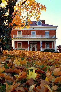
Other important sites located in or near the town include the Bear Mountain Indian Mission School, Edgewood, 1818, Edgewood, 1858, Fairview, Forest Hill, The Glebe, Dulwich Manor, and Tusculum. These places are also listed on the National Register of Historic Places.
Geography
Amherst is located at 37°34′37″N 79°3′2″W (37.576899, -79.050424). According to the United States Census Bureau, the town has a total area of 5.0 square miles (12.9 km²), all of it land.
The Town of Amherst is 25 miles southeast of Lexington, Virginia, 44 miles southwest from Charlottesville, Virginia, 20 miles northwest from Appomattox, Virginia, and only 13 miles north of Lynchburg, Virginia.
Demographics
As of the census of 2000, there were 2,251 people, 940 households, and 568 families residing in the town. The population density was 451.3 people per square mile (174.2/km²). There were 1,000 housing units at an average density of 200.5 per square mile (77.4/km²). The racial makeup of the town was 68.95% White, 29.63% African American, 0.31% Native American, 0.31% Asian, 0.04% from other races, and 0.76% from two or more races. Hispanic or Latino of any race were 1.02% of the population.
There were 940 households out of which 28.2% had children under the age of 18 living with them, 43.4% were married couples living together, 14.6% had a female householder with no husband present, and 39.5% were non-families. 37.0% of all households were made up of individuals and 19.7% had someone living alone who was 65 years of age or older. The average household size was 2.18 and the average family size was 2.84.
In the town, the population was spread out with 21.6% under the age of 18, 6.1% from 18 to 24, 24.4% from 25 to 44, 23.5% from 45 to 64, and 24.3% who were 65 years of age or older. The median age was 43 years. For every 100 females there were 84.7 males. For every 100 females age 18 and over, there were 77.3 males.
The median income for a household in the town was $33,000, and the median income for a family was $44,181. Males had a median income of $35,714 versus $20,321 for females. The per capita income for the town was $18,457. About 13.3% of families and 18.0% of the population were below the poverty line, including 25.1% of those under age 18 and 26.5% of those age 65 or over.
Education
The Town of Amherst has many public schools which provide primary and secondary education to local children. There are also opportunities for higher learning.
Amherst County School System operates the public education system in Amherst. The Public schools in the Amherst area are:
In addition, the Town of Amherst is served by the women's liberal arts college Sweet Briar College.
Central Virginia Community College has a small center in the Town of Amherst that serves the community in higher education.
Local economics
The Town of Amherst has several places of business and commerce that provide products and jobs for the community. Major employers in and near the town include:
Town services
The Town of Amherst provides services for the town (and in some cases outside the corporate limits) including:
Transportation
There is no public transportation in the Town of Amherst. All forms of transportation and transportation services are privately owned.
Lynchburg Regional Airport is located along U.S. 29 approximately 20 miles south of the Town of Amherst. Falwell Aviation, Inc., a general utility airport is located on U.S. 29 in the City of Lynchburg. Both airports are used by small aircraft for business and pleasure flying. Commercial passenger service is available at Lynchburg Regional, and Falwell Aviation has facilities for the landing of small private jet aircraft. Air freight service is available from Lynchburg Regional. Other air services are available nearby in Charlottesville, Roanoke, Richmond and Washington, D.C., and Durham, North Carolina.
Norfolk Southern's north-south mainline between Washington, D.C., and Birmingham, Alabama, passes through the Town of Amherst. This line serves Clorox (formerly Glad Manufacturing).
Passenger service to the Town was discontinued some years ago, but the Amtrak Crescent, using the NS mainline, passes through the Town on its daily trip between Washington, D.C., and New Orleans and may be boarded at Lynchburg and Charlottesville.
Greyhound Bus Company has flag stop passenger service in Amherst, stopping for passengers as necessary while traveling U.S. Route 29.
The Town of Amherst is served by several interstate and intrastate motor freight companies located throughout Central Virginia. These freight companies provide extensive coverage throughout the eastern United States and many areas of the Midwest and Canada.
Carrier service is provided by United Parcel Service, Purolator, Emery, Courier Express and Federal Express.
Major highways and roads
There are two major highways in the town of Amherst: U.S. Route 29 and U.S. Route 60.
A multi‑lane highway passing from Baltimore, Maryland, through Amherst and southward to Pensacola, Florida. About 15 miles south of Town, Route 29 intersects with U.S. Route 460, a major east-west highway, Interstate 64 which intersects with U.S. Route 29 about 45 miles north of the town.
There are two routes relating to U.S. Route 29 running through the Town of Amherst which are U.S. 29 and U.S. 29 Business. U.S. 29 Business was the former route of U.S. 29 but a bypass around the downtown area was constructed which made the former routing obsolete.
A two-lane highway through Amherst, is an east-west highway stretching from the Atlantic Ocean at Virginia Beach to the Pacific Ocean at Los Angeles. Route 60 provides both a direct route of travel from Amherst to the state capitol in Richmond and is the area's link with Interstate 81, a north‑south interstate that passes through the Shenandoah Valley.
Healthcare
Amherst does not have an emergency room (those in need of emergency health service utilize Centra's Lynchburg General Hospital), but Amherst does have several healthcare offices and organizations including
In 2014, Centra announced that it plans to open a new ambulatory care facility in Amherst.
Tourism
The Town of Amherst has many different attractive outdoor spots that are very tourist-friendly. These attractions provide beautiful natural entertainment and are good places for fishing, hiking, picnics, and other outdoor pleasures. These locations include: