
 | ||
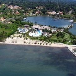
Amatique bay resort marina puerto barrios izabal guatemala x
Amatique Bay is a large bay in the Gulf of Honduras, along the eastern coast of Guatemala and Belize. It stretches from Santo Tomás de Castilla in the south to Punta Gorda in the north. Its south-eastern limits are marked by a small peninsula known as Punta de Manabique where a $27 million gas terminal is planned (http://www.elperiodico.com.gt/es/20110519/economia/195588)
Contents
- Amatique bay resort marina puerto barrios izabal guatemala x
- Map of Amatique Bay
- Amatique bay welcome to amatique bay resort marina
- References
Map of Amatique Bay
Most of the bay is part of Guatemala, while the northwestern portion is part of Belize. The bay receives the runoff from three major rivers: the Moho River in Belize, the Sarstoon River forming the border between Belize and Guatemala, and Dulce River in Guatemala. Main ports in the bay are Puerto Barrios, Santo Tomás de Castilla and Livingston (Guatemala), and Punta Gorda (Belize).