
District Ōshima Population 6,350 (1 Jun 2013) Local time Monday 10:18 PM | Area 80.35 km² | |
 | ||
Weather 12°C, Wind N at 18 km/h, 60% Humidity | ||
Amagi (天城町, Amagi-chō) is a town located on Tokunoshima, in Ōshima District, Kagoshima Prefecture, Japan.
Contents
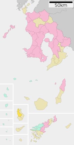
- Map of Amagi Oshima District Kagoshima Prefecture Japan
- Geography
- Surrounding municipalities
- History
- Ports
- Airport
- Noted people from Amagi
- References
Map of Amagi, Oshima District, Kagoshima Prefecture, Japan
As of June 2013, the town has an estimated population of 6,350 and a population density of 79 persons per km². The total area is 80.35 km². The economy of the town is based on sugar cane, beef and seasonal tourism.
Geography
Amagi occupies the northeastern portion of the island of Tokunoshima, with the East China Sea to the west. The climate is classified as humid subtropical (Köppen climate classification Cfa) with very warm summers and mild winters. Precipitation is high throughout the year, but is highest in the months of May, June and September.
Surrounding municipalities
History
Amagi Village was established on April 1, 1908. As with all of Tokunoshima, the village came under the administration of the United States from 1 July 1946 to 25 December 1953. On 1 January 1961, Amagi was upgraded to town status.