
Postal codes 56288 Area 7.58 km² Population 440 (31 Dec 2008) Dialling code 06762 | Time zone CET/CEST (UTC+1/+2) Dialling codes 06762 Local time Monday 6:46 AM Postal code 56288 | |
 | ||
Weather 8°C, Wind SW at 19 km/h, 74% Humidity | ||
Axel fischer amsterdam live konzert alterk lz
Alterkülz is an Ortsgemeinde – a municipality belonging to a Verbandsgemeinde, a kind of collective municipality – in the Rhein-Hunsrück-Kreis (district) in Rhineland-Palatinate, Germany. It is also a tourism community (Fremdenverkehrsgemeinde).
Contents
- Axel fischer amsterdam live konzert alterk lz
- Map of 56288 AlterkC3BClz Germany
- Musikverein alterk lz
- Location
- History
- Municipal council
- Mayor
- Coat of arms
- Buildings
- Established businesses
- Famous people
- References
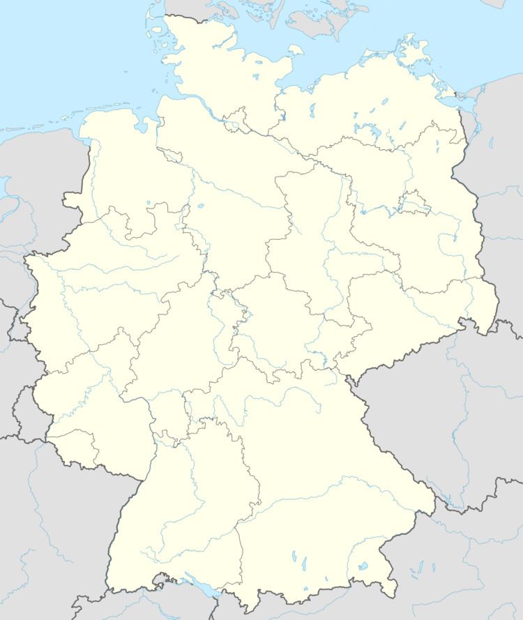
Map of 56288 Alterk%C3%BClz, Germany
Musikverein alterk lz
Location
The municipality lies in the Külzbach valley, stretching strikingly along Landesstraße (State Road) 108, which is known locally as Hauptstraße (“Main Street”) where it actually passes through the village. Its length along this road has led to Alterkülz being called the “Longest Village in the Hunsrück”. Also belonging to the municipality is the outlying centre of Osterkülzmühle in the Osterkülz valley, southeast of the main centre.
Alterkülz’s neighbours, by compass direction, are as follows:
History
Alterkülz belonged until 1417 to the “Further” County of Sponheim, and locally to the Amt of Kastellaun. After this line of the Sponheims died out, the village went with Kastellaun to the “Hinder” part of the County.
Over the centuries, Alterkülz grew together from several villages: Unterdorf (“Lower Village”), Mitteldorf (“Middle Village”), Überbach and Wehr. As late as 1865, the now Ortsteil of Wehr was mentioned as a hamlet in its own right.
On the way out of the village to the south, near the Külzbach, the local river, are found remnants of a mediaeval iron smelter and what is left of the mine whence the ore came, the Grube Eid. Also found there is a slope on which once stood a Roman estate, a villa rustica.
From 1901 to 1983, the village was a stop on the old Simmern–Kastellaun–Boppard Hunsrückbahn (railway). At the beginning of the 21st century, the former railway right-of-way was converted into an asphalt-paved cycle and hiking path, the Schinderhannes-Radweg, named after a famous German outlaw.
In 2005, the municipality reached fifth place in the area in the state contest Unser Dorf hat Zukunft (“Our village has a future”).
Municipal council
The council is made up of 8 council members, who were elected at the municipal election held on 7 June 2009, and the honorary mayor as chairman.
Mayor
Alterkülz’s mayor is Klaus Häfner.
Coat of arms
The German blazon reads: Im geteilten Schild oben in Schwarz ein aufspringender goldener Ziegenbock, beseitet von zwei goldenen Ähren, unten von Rot und Silber geschachtet, belegt mit schräggekreuzten schwarzen Schlägel und Hammer.
The municipality’s arms might in English heraldic language be described thus: Per fess sable a billygoat springing between two ears of wheat couped in base Or and chequy of twenty-four gules and argent a hammer and a sledge per saltire of the first.
The red and silver checkerboard pattern in the lower half of the escutcheon refers to the village’s former allegiance to the “Hinder” County of Sponheim and the Amt of Kastellaun. As early as 1283, Alterkülz was being mentioned in a few Sponheim documents (cule, kultze). The charge here, the hammer and sledge, recall the iron ore mining that was undertaken at the Grube Eid (mine) from 1780 (as it is established in historical records) until the First World War. The ears of wheat stand for agriculture, once every villager’s occupation. Many lordships were enfeoffed here, the Sponheims, the Koppensteins, the Hunolsteins and the Bourscheids. The springing billygoat represents the outlying centre of Wehr, where the Wehrer Bick live, Bick being a local form of the German Böcke (“bucks”, “male animals”, and thus in this case, “billygoats”). The billygoat also graces the new town hall’s roof.
The arms have been borne since 23 February 1981.
Buildings
The following are listed buildings or sites in Rhineland-Palatinate’s Directory of Cultural Monuments:
Established businesses
Among others, there are a large steel building firm, a carpentry company specializing in building conservatories, a masonry business, an inn and several agricultural businesses. On a hill east of the village stands a wind farm with seven wind turbines made by Vestas.