
The next alpine fault earthquake in new zealand
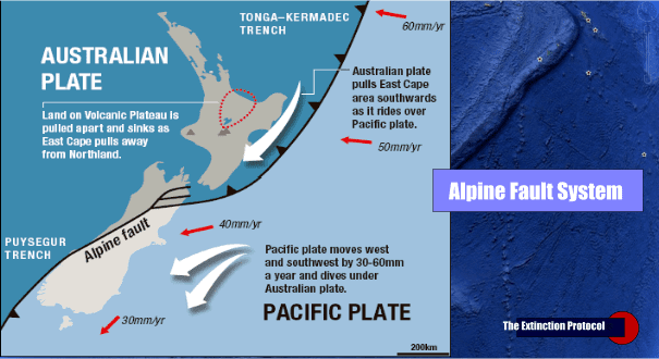
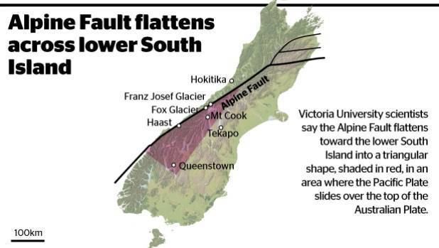
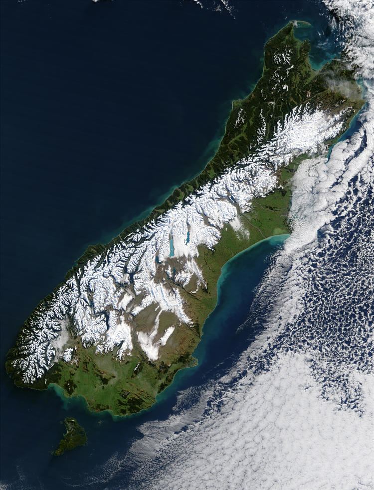
The Alpine Fault is a geological fault, specifically a right-lateral strike-slip fault, that runs almost the entire length of New Zealand's South Island. It forms a transform boundary between the Pacific Plate and the Indo-Australian Plate. Earthquakes along the fault, and the associated earth movements, have formed the Southern Alps. The uplift to the southeast of the fault is due to an element of convergence between the plates, meaning that the fault has a significant high-angle reverse oblique component to its displacement.
Contents
- The next alpine fault earthquake in new zealand
- Digging into the alpine fault
- Historic earthquakes
- Major ruptures
- References
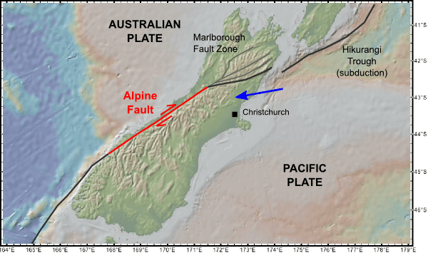
The Alpine Fault is believed to align with the Macquarie Fault Zone in the Puysegur Trench off the southwestern corner of the South Island. From there, the Alpine Fault runs along the western edge of the Southern Alps, before splitting into a set of smaller dextral strike-slip faults north of Arthur's Pass, known as the Marlborough Fault System. This set of faults, which includes the Wairau Fault, the Hope Fault, the Awatere Fault, and the Clarence Fault, transfer displacement between the Alpine Fault and the Hikurangi subduction zone to the north. The Hope fault is thought to represent the primary continuation of the Alpine fault.
Average slip rates in the fault's central region are about 30mm a year, very fast by global standards.
Digging into the alpine fault
Historic earthquakes
The Alpine Fault and its northern offshoots have experienced sizable earthquakes in historic times:
Major ruptures
Over the last thousand years, there have been four major ruptures along the Alpine Fault causing earthquakes of about magnitude 8. These had previously been determined to have occurred in approximately 1100, 1430, 1620 and 1717 CE, at intervals between 100 and 350 years. The 1717 quake appears to have involved a rupture along nearly 400 kilometres (250 mi) of the southern two thirds of the fault. Scientists say that a similar earthquake could happen at any time as the interval since 1717 is longer than between the earlier events. Newer research carried out by the University of Otago and the Australian Nuclear Science and Technology Organisation revised the dates of the pre-1717 earthquakes to between 1535 and 1596 (instead of 1620), 1374 and 1405 (instead of 1430), and 1064 and 1120 (instead of 1100). In addition, an earlier earthquake was identified to have occurred between 887 and 965.
GNS Science researchers have compiled an 8000-year timeline of 24 major quakes on the (southern end of the) fault from sediments at Hokuri Creek, near Lake McKerrow in north Fiordland. In earthquake terms, the 850 kilometres (530 mi) long fault is remarkably consistent, rupturing on average each 330 years, at intervals ranging from 140 years to 510 years.
Large ruptures can also trigger earthquakes on the faults continuing north from the Alpine Fault. There is paleotsunami evidence of near-simultaneous ruptures of the Alpine fault and Wellington (and/or other major) faults to the North having occurred at least twice in the past 1,000 years.