
Time zone EET (UTC+2) Vehicle registration ΒΟ Area 909.8 km² Area code 24220 | Elevation 70 m (230 ft) Postal code 371 00 Website almyros-city.gr Local time Sunday 7:43 PM | |
 | ||
Weather 11°C, Wind SE at 16 km/h, 95% Humidity | ||
Almyros or Halmyros (Greek: Αλμυρός, which means salty) is a town and a municipality of the regional unit of Magnesia, region of Thessaly, Greece. It lies in the center of prosperous fertile plain known as 'Krokio Pedio', which is crossed by torrents. Almyros is an important agricultural and commercial center of Magnesia, and is also developing as a tourist center for the area. The main agricultural products are tomatoes, cotton, wheat, almonds, peanuts and pistachio nuts.
Contents
Map of Almiros 371 00, Greece
History
The history of Almyros begins with the ancient city of Alos (about 10 km south of Almyros), the ruins of which can still be visited. Alos was a very important and populous town, famous for its port and for its role in the Persian Wars. After the Byzantine Empire, because of pirate raids, they built the town in the place that it is today.
Halmyros was the site of the decisive Battle of Halmyros on 15 March 1311, where the Catalan Company shattered the assembled feudal armies of Frankish Greece and conquered the Duchy of Athens.
In 1838, the settlement was described as being "a Turkish town, situated on the western coast of the Pagasitic Gulf, half an hour's journey inland, on the Plain of Krokios, and consisting of some 300 dwellings. It is chiefly inhabited by Turks, with only a few Christian settlers, who cultivate the lands of the Turks residing there". The Ottoman Empire ceded most of Thessaly in 1881, followed by development and repopulation by Greeks.
In 1980 a catastrophic magnitude 6.5 earthquake destroyed most of the town.
Municipality
The municipality Almyros was formed at the 2011 local government reform by the merger of the following 4 former municipalities, that became municipal units:
The municipality has an area of 905.364 km2, the municipal unit 473.940 km2.
Subdivisions
The municipal unit of Almyros is divided into the following communities: Almyros, Efxeinoupoli, Anthotopos, Kokkotoi, Kroki, Kofoi, Platanos, and Fylaki.
Province
The province of Almyros (Greek: Επαρχία Αλμυρού) was one of the provinces of Magnesia. It had the same territory as the present municipality. It was abolished in 2006.
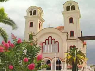
Landmarks
Geography
Almyros is situated near the western end of the Pagasetic Gulf, 25 km southwest of Volos. Motorway 1 (Athens – Thessaloniki) passes east of the town Almyros.