
Length 454 m (1,490 ft) Impound Kelkit River | Opening date 1966 Height 78 m (256 ft) Operator State Hydraulic Works | |
 | ||
Similar Kesikköprü Dam, Adıgüzel Dam, Hasan Uğurlu Dam, Kozan Dam, Kuzgun Dam | ||
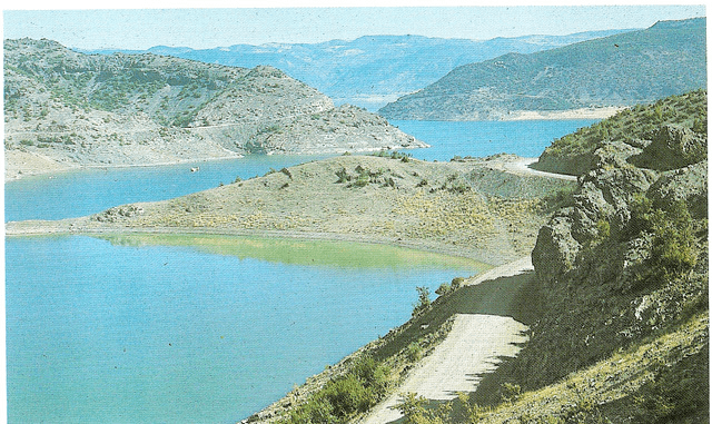
The Almus Dam (Almus Barajı in Turkish) is an earthen embankment dam that is near the town of Almus (28 kilometers East of Tokat city in center north of Turkey) and is located on the River Yesilirmak which runs into the Black Sea. The main purposes of the dam is irrigation, flood control and hydroelectricity. The hydroelectric power plant (established in 1966) at the dam has a capacity of 27 megawatts (three facilities at 9 megawatts each). The dam contains 3,405,000 m3 (120,200,000 cu ft) of material and irrigates an area of 21,350 hectares. The dam's spillway is capable of discharging a maximum 2,800 m3/s (98,881 cu ft/s) and its bottom outlet a maximum of 50 m3/s (1,766 cu ft/s).
Map of Almus Dam, 60900 Almus%2FTokat, Turkey
References
Almus Dam Wikipedia(Text) CC BY-SA