
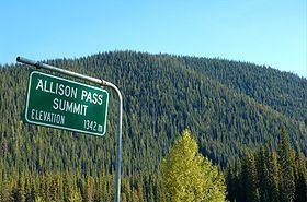
Elevation 1,342 m | ||
 | ||
Range North Cascades, Cascade Range | ||
Allison pass manning park bc 02 15 2014 backcoutry
Allison Pass (el. 1,342 m or 4,403 ft) is a highway summit along the Crowsnest Highway in British Columbia, Canada. It is the highest point on the highway between the cities of Hope and Princeton. It is located in the middle of Manning Park, at the divide between the Skagit & Similkameen River drainages, as well as on the boundary between the Fraser Valley and Okanagan-Similkameen Regional Districts, approximately 12 km (7 mi) west of the Manning Resort and 54 km (34 mi) from Hope. The Skagit originates at the pass while the Similkameen originates just north of it.
Contents
- Allison pass manning park bc 02 15 2014 backcoutry
- Map of Allison Pass Okanagan Similkameen H BC Canada
- Kihei sands a14 tony allison pass
- HistoryEdit
- References
Map of Allison Pass, Okanagan-Similkameen H, BC, Canada
Cyclists and motorists alike find this stretch of road difficult because of the steep grades and high altitudes. On the way from Hope to Allison Pass, one must ascend the 7% (1 in 14) grades up to the Hope Slide before one can start up to Allison Pass, leaving many trucks waiting at the side of the road for their engines to cool down.
Kihei sands a14 tony allison pass
HistoryEdit
The pass was named after John Fall Allison, a rancher living in Princeton.