
Population 211 (2011 census) Postal code 3364 | Postcode(s) 3364 Local time Sunday 9:10 PM | |
 | ||
Location 140 km (87 mi) WNW of Melbourne26 km (16 mi) N of Ballarat9 km (6 mi) N of Creswick3 km (2 mi) W of Kingston Weather 21°C, Wind SE at 11 km/h, 51% Humidity | ||
Allendale (aka Allandale) is a town in Victoria, Australia, located north-east of Creswick, in the Shire of Hepburn. At the 2011 census, Allendale and the surrounding area had a population of 211.
Map of Allendale VIC 3364, Australia
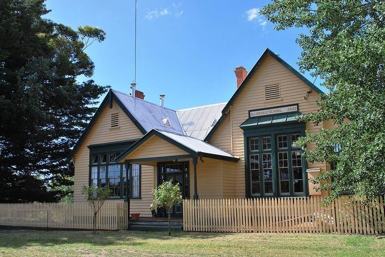
The town began as a mining settlement around the Berry Leads mining area. It had a peak population of about 1,500. Allendale once had ten hotels, railway station, post office, bakery, and shops, all of which have closed. The small boarding school located in Leishman Street was sold in 2005. Allendale Post Office opened on 6 May 1881, was known as Allandale from 1885 to 1893, and closed in 1974.
Allendale Railway Station was on the North Creswick to Daylesford line. The railway closed in sections with Allendale to Newlyn closed on December 1, 1976, and from North Creswick to Allendale on December 8, 1986.