Established late 1990s Use Hiking | Length 42 mi (68 km) Designation National Recreation Trail | |
 | ||
Hazards Severe Weather, Poison ivy, Bears, Poisonous Snakes | ||
Winter backpacking allegheny front trail
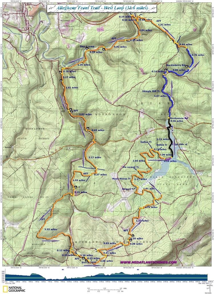
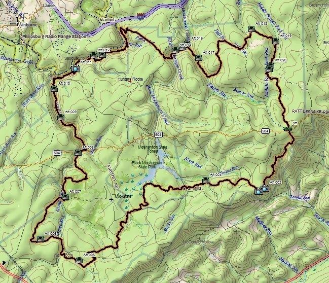
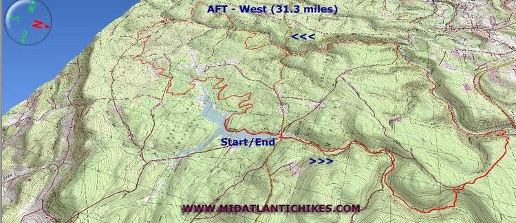
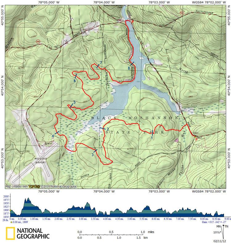
The Allegheny Front Trail, a relatively new trail in western Centre County, was built collaboratively in the late 1990s by Penn State Outing Club, Ridge & Valley Outings Clubs, Quehanna Area Trails Club, and the Keystone Trails Association. The trail provides a wide variety of forest environments, including views over valleys to the east, trout streams, and marshlands. The orange-blazed trail surrounds Black Moshannon State Park and crosses Pennsylvania Route 504 twice, though there is almost no road walking. Since its inception, the Allegheny Front Trail has changed very little, except for the addition of bog bridges through Black Moshannon Swamp upstream from Shirk Road.
Contents
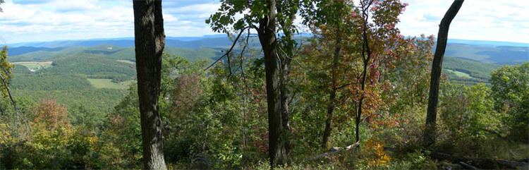
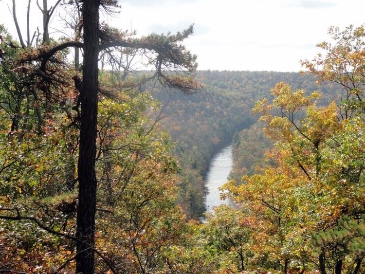
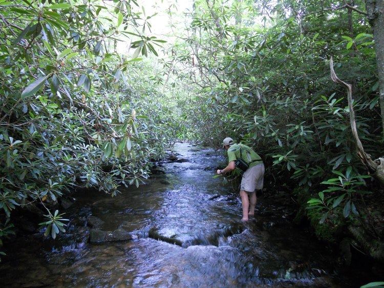
Scattered along the trail are six trout streams; an acid-polluted stream of interest to activists, known as "Red" Moshannon Creek; and various small brooks. The trail includes about 3 miles (4.8 km) on the edge of the Allegheny Front, with six identified vistas and some areas of nearly continuous views; extensive portions of the Ridge and Valley Province to the southeast are visible. Hiking is very rocky and steep along this portion of the trail, but hikers are rewarded with some of the finest overlooks in all of Pennsylvania.
You can easily find water on most of the Allegheny Front Trail even during droughts, but there is one 6-mile-long (9.7 km) dry section from Smays Run to the headwaters of Benner Run. The works of beavers are easily seen on the southwest and northeast sections. Shorter loop hikes of 26 miles (42 km) (on the eastern portion) and 20 miles (32 km) (on the western portion) are possible by walking through Black Moshannon State Park via the blue-blazed Shingle Mill Trail along Black Moshannon Creek, and then the park's orange-blazed Moss-Hanne Trail. In the state park, camping is permitted only at the official campground.
Greate Buffaloe Swamp (2001), by Ralph Seeley, combines a trail guide with a historical narrative for the Black Moshannon area. The new Guide to the Allegheny Front Trail (2014, ISBN 9780985193980) by Ben Cramer provides detailed advice for hiking the AFT and includes turn-by-turn instructions, photos, and maps.
The Allegheny Front Trail is accessed via PA 504 to the east and west of Black Moshannon State Park, with intermediate access points on several nearby back roads.
Allegheny front trail 2016