
Country Canada Time zone EST (UTC-5) Population 2,156 (2011) | Elevation 443 m (1,453 ft) Postal Code FSA K0M Local time Saturday 4:09 AM | |
 | ||
Weather 1°C, Wind E at 10 km/h, 97% Humidity Points of interest Oxtongue River ‑ Ragged F, Booth's Rock Trail, Stanhope Heritage Discovery, Leslie M Frost Natural R | ||
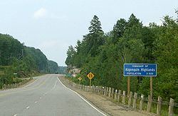
Algonquin highlands trip 11 oct 2015
Algonquin Highlands is a township located in Haliburton County, Ontario, Canada. It has a population of 1,976. The northeastern section of the township is included in Algonquin Provincial Park.
Contents
- Algonquin highlands trip 11 oct 2015
- Map of Algonquin Highlands ON Canada
- Fall colours of algonquin highlands trail part 1
- Communities
- Demographics
- References
Map of Algonquin Highlands, ON, Canada
The township was formed through the amalgamation of Stanhope and Sherborne et al. townships, the latter of which included McClintock, Livingstone, Lawrence and Nightingale. It was thereafter briefly known as the Township of Sherborne, Stanhope, McClintock, Livingstone, Lawrence and Nightingale until it was renamed to its current name in March 2001.
The township lacks a commercial center, but its municipal offices are located on North Shore Road, 5 km north of Carnarvon at 45°05′09″N 78°41′36″W. A satellite municipal office is located in Dorset, the main street of which straddles the border of Algonquin Highlands to the east and Lake of Bays to the west.
Fall colours of algonquin highlands trail part 1
Communities
The township includes half the village of Dorset, part of Carnarvon and the hamlets of Boshkung, Buttermilk Falls, Halls Lake, Little Hawk Lake, Maple Lake, Ox Narrows, and Oxtongue Lake.
Demographics
According to the Canada 2006 Census:
Population trend: