
Airport type Public 03/21 5,000 Code MFV Phone +1 757-787-4600 | Elevation AMSL 47 ft / 14 m 5,000 1,524 Elevation 14 m | |
 | ||
Similar County Garage, Accomack County Sheriff, Accomack County Circuit Co, Accomack County Public Sc, Accomack Environm Health | ||
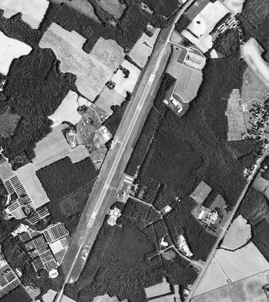
Accomack County Airport (IATA: MFV, ICAO: KMFV, FAA LID: MFV) is a county-owned public-use airport located 1 mile (1.6 km) west of the central business district of Melfa, a city in Accomack County, Virginia, United States.
Contents
Virginia hang gliding at accomack county airport
History
The airport was built by the United States Army Air Forces about 1942, and was known as Melfa Flight Strip. It was an emergency landing airfield for military aircraft on training flights. It was closed after World War II, and was turned over for local government use by the War Assets Administration (WAA).
Facilities and aircraft
Accomack County Airport covers an area of 100 acres which contains one runway designated 3/21 with a 5,000 x 100 ft (1,524 x 30 m) asphalt surface. For the 12-month period ending September 30, 2009, the airport had 14,056 aircraft operations, an average of 38 per day: 84% general aviation and 8% air taxi and 9% military. At that time there were 23 aircraft based at this airport: 22 single-engine and 1 multi-engine.