
Elevation 1,256 m (4,121 ft) Postal code 50xxx Area 497 km² Area code 0384 | Region Central Anatolia Time zone EET (UTC+2) Vehicle registration 50 Local time Thursday 6:02 AM | |
 | ||
Weather 6°C, Wind E at 21 km/h, 61% Humidity | ||
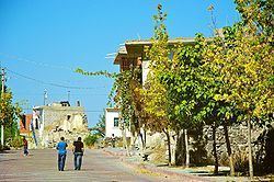
Acıgöl, ([ˈadʒɯɡøɫ]) formerly Dobada, is a town and district of Nevşehir Province in the Central Anatolia region of Turkey. According to 2010 census, population of the district is 15,040 of which 5,825 live in the town of Acıgöl, and the remainder in surrounding villages. The district covers an area of 497 km2 (192 sq mi), and the town lies at an average elevation of 1,256 m (4,121 ft). Acıgöl has 5 towns and 8 villages.
Map of Ac%C4%B1g%C3%B6l, Turkey
References
Acıgöl Wikipedia(Text) CC BY-SA