
Range Andes | ||
 | ||
Similar Viaducto La Polvorilla, Cuesta del Obispo, Calchaquí Valleys, Cerro Tuzgle, Sico Pass | ||
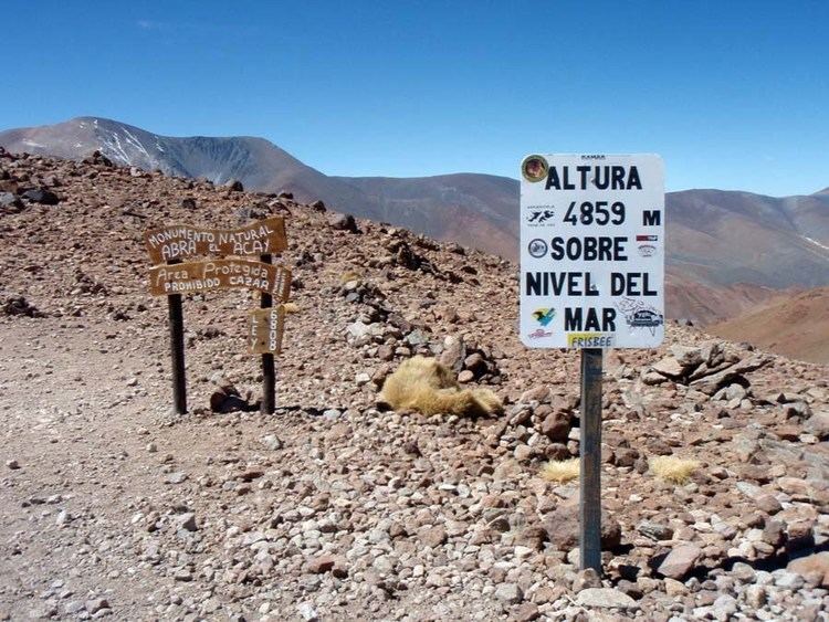
The Abra del Acay in La Poma Departament, Salta Province, Argentina is the highest point in Argentina's National Route 40. Located at 24°23′S 66°14′W, its altitude is 4,972 meters (16,312 ft), even though an old sign informs visitors it stands at 4,895 meters (16,060 ft).
Map of Abra del Acay, Salta Province, Argentina
The Abra del Acay is approximately 25 kilometers (16 mi) geodesic distance southeast from San Antonio de los Cobres, although the direct route by road is about 45 kilometers (28 mi).
Inaugurated on 8 July 1960 after three years of construction, this unpaved part of the National Route 40 is only suitable for all-terrain vehicles, with the exception of some months in the year when meteorological and maintenance conditions allow normal vehicles to transit. The road inclination of 4.5% and oxygen deprivation due to altitude make the crossing difficult for both vehicles and people.