
 | ||
Is a village in the Union Council of Kota Swat, Tehsil Barikot in the district of Swat,Khayber Pukhtoonkhwa. It is situated between the two villages of Goratai and Kota. The village has an estimated population of 9000 people. Aboha has a history of early settling by Hindus, and now the residency of Pathans or Pashto speaking people.The village is famous for its spring source water which acts as a valuable resource, donating its freshness to a whole variety of buildings, and structures. Aboha is part of the 3 village municipality, of Naway Kalalay, and Kota.
Contents
- Map of Aboha Pakistan
- Geography and climate
- History
- Culture and religion
- Population
- Education
- Populational Occupations
- Infrastructure
- References
Map of Aboha, Pakistan
Geography and climate
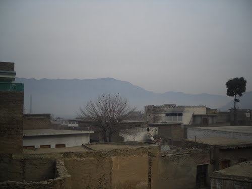
Due to its position in a mountainous area of Swat,The expansion of the city and its placement on the 3 hills, makes the village able to expand, however providing the risks of going deeper into the mountains. Aboha enjoys its light early monsoon rains with Seasonal variety is moderate with hot summers and cold winters. The Gishow, or agricultural field side of the village is irrigated by the Swat river. A fresh supply of water arrives in the late spring and early summer. makes the village, a place worth living in. The river helps to irrigate the fields and agricultural land nearby.The expansion of the city and its placement on the 3 hills, makes the village able to expand, however providing the risks of going deeper into the mountains. The middle mountain has also opened a path to the plains of Malkidam, where most of the landowners have their agricultural land, therefore connecting the two heavily commonly used paths.
History
The first and most early settlers dated about two thousand years ago. Alexander The Great, also went through the village and then crossed to the other side of the Swat river. However Aboha, back then was just a small collection of houses, that provided very little assistance to the armies that passed. However, due to the peace and serenity it offered. Proof and evidence for their residence in the Swat valley can be proven by the Statues of Buddhas and the cravings on the mountains in the rural areas of Swat
Culture and religion
The main religion of the region is Islam. In face the whole population is Muslim. There are mosques every 600 metres (2,000 ft) to the south and west to fulfill the requirements of the daily prayers. The Athan also occurs there 5 times a day, 7 times a week, calling everyone to prayer and mosques. . There is a big spring which provides water to six mosques directly.
Population
The population of the village has drastically increased in the years. On average each nucleic family contains 3–5 family members.The expansion of the city and its placement on the 3 hills, provided the population to increase the construction of houses and buildings. 2014 records showed the numbers crossing the 9-12 thousands line. Further growth and population expansion is expected.
Education
Aboha provides the people with a fair quantity of Elementary and secondary school institutions. There are about 4 privately owned learning institutions with about 5 government schools, including the Girls high school, three boys Primary Schools, with 1 elementary and then the girls high school. Although new schools are not being built, education is one of the top priority of the population. People seek and crave learning due to now knowing the importance of education and its successful results. An example would be Islamia Public School Public School, located in the middle of the village. The competition was very high most of the students just off positions because of .5 or 1 %s. About almost every child attends a schooling the village.
Populational Occupations
Occupations are of a broad range, starting from medical doctors and ending with paid workers and farmers. These factors are nor precisely accurate but are thougtful estimations and are based on the working class, not the youth and children. Women are excluded as well. 3% are medical or medicine related fields of work. 17% are employees or staff operating in shops. 65% gain their economy from managing land, and then exporting their produce to shops and other markets. 8% work in the fields and on construction sites. 7% other.
Infrastructure
The main road coming from Mingora and diverging after the Malakand mountains, makes its way through Aboha. Although there are no sidewalks, there are ledges in front of stores and shops which allow a safe walk. There are streets running through the village, connecting alley way to alley. There is also a cell phone tower, operating a Telenor phone service signal. Roads have also been led to Government institutions and buildings. The popularity of the Swat river has also carved out a cement road that is used by civilians and is also accessible to cars. There are also many other small paths and natural ways that lead to the numerous agricultural fields, in the direction of the Swat River, left and right.
The repairing and the construction of these roads and paths are mostly done by the private sector. The villagers usually tend to their own pathways and roads when attention is required towards it.