
Municipality Abejuela Elevation 1,169 m | Time zone CET (UTC+1) Area 86.67 km² Local time Tuesday 11:55 AM | |
 | ||
Weather 7°C, Wind W at 27 km/h, 57% Humidity | ||
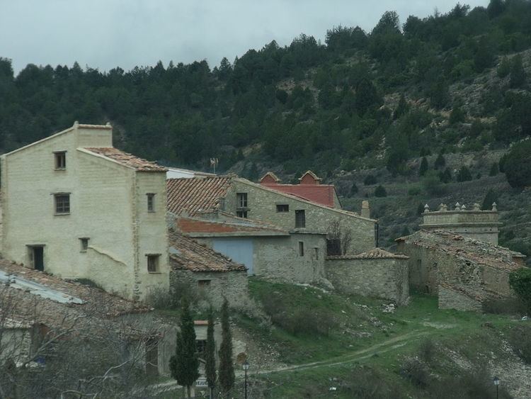
Abejuela is a municipality located in the province of Teruel, Aragon, Spain. According to the 2004 census (INE), the municipality has a population of 68 inhabitants. It is the southernmost town in Aragon.
Contents
Map of 44422 Abejuela, Teruel, Spain
Sierra de Javalambre rises north of the town and Sierra del Toro to the east.
Economy
The economy of Abejuela is focused primarily on agriculture and livestock raring. Some crops include wheat, barley, and outstanding quality truffle plantations, one of the best there is in Spain. Livestock raring is also high quality because all livestock are fed almost completely 100% natural.
History
There is little documentation on Abejuela, because almost all its files were destroyed in the Civil War.
It is known from oral tradition, that the first settlers were people exiled to its highest and coldest point called Almansa, where the hermitage of Santa Margarita is located. It is believed that around the fifteenth century the first buildings on what is now Abejuela were built, these are the Church and the military tower in the square.
Abejuela, is still one of the few towns that retains almost all of its architecture intact, with renovations remaining faithful to its surroundings and despite the years they have been kept in perfect condition.
Location
The distance of Abejuela from Teruel is 79 km, 78 km from Valencia. It is within the Gúdar Javalambre region. Abejuela, has 8000 hectares of forest and farmland between altitudes of 800m and 1610m. The population is located at 1167 m high.
For more than 50 years Abejuela maintained communication with its province (Teruel) since at this time it was only accessible from Aragon by a municipal road or a detour of 35 kilometers through the province of Valencia.
The municipal district of Abejuela is bounded by Manzanera on the north, south and west by the Yesa, Chelva and Higueruelas and on the east by Andilla and el Toro, all these in the Valencia province except El Toro (Castellon).
La Cervera
Within the municipality is the hamlet of La Cervera. Unfortunately it is undergoing total abandonment, due to the lack of electricity and water. La Cervera is located about 8 km from the town and in its time was critical to the survival of Abejuela, because the weather there was softer and its lands were used for grazing and other necessities which in times of snow were useful within the district.
Feasts
The following feasts are celebrated on the following dates: