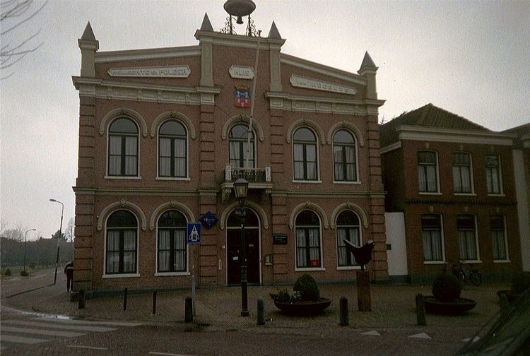
Website www.abcoude.nl Population 8,657 (1 Jan 2007) | Time zone CET (UTC+1) Area 32.11 km² Local time Tuesday 9:08 AM | |
 | ||
Weather 3°C, Wind SW at 32 km/h, 90% Humidity | ||
Abcoude ( pronunciation ) is a town and former municipality in the Netherlands, in the province of Utrecht. Since 2011 it has been part of the municipality of De Ronde Venen.
Contents
- Map of Abcoude Netherlands
- Population centres
- Geography
- History
- Transport
- Local government
- Other
- References
Map of Abcoude, Netherlands
Population centres
The former municipality of Abcoude consisted of the villages Abcoude and Baambrugge, and the hamlet Stokkelaarsbrug.
Geography
Abcoude lies in the Province Utrecht, about 13 km southeast of (the centre of) Amsterdam, on the confluence of the Angstel River, Gein River and Holendrecht River.
In 2001, the town of Abcoude had 6431 inhabitants. The built-up area of the town was 1.28 km², and contained 2678 residences. The current approximation is over 8000.
History
Abcoude was first mentioned in a report from 1085 by the bishop of Utrecht. In this document the residents of Abcoude were named ’habitatores de Abecenwalde’. In 1672 most of the town was burned down by the French. In 1820 Abcoude had 1100 inhabitants.
The municipality of Abcoude was formed in 1941, from the former municipalities of Abcoude-Proosdij (containing the village of Abcoude) and Abcoude-Baambrugge (containing the village of Baambrugge).
Transport
The town is served by Abcoude railway station. It is in the northern part of Abcoude. The station offers direct services to Amsterdam, Utrecht, Gouda and Rotterdam.
Local government
Till 2011 the municipal council of Abcoude consisted of 13 seats, which were divided as follows:
Other
Abcoude is famously known as the only town to start with the letters A, B, and C in that order.
