
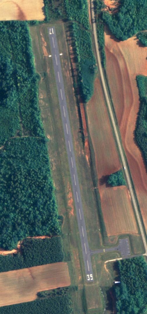
Airport type Public 17/35 2,900 Address Abbeville, AL 36310, USA | Owner City of Abbeville Elevation AMSL 468 ft / 143 m 2,900 884 Elevation 143 m | |
 | ||
Similar Walker Realty Inc, Henry County Probate J, Baker Realty, Henry County District Att, Henry County Clerk of C | ||
Abbeville Municipal Airport (FAA LID: 0J0) is a city-owned, public-use airport located three nautical miles (6 km) north of the central business district of Abbeville, a city in Henry County, Alabama, United States. It is the only airport that serves the city of Abbeville.
Contents
This airport is included in the FAA's National Plan of Integrated Airport Systems for 2011–2015 and 2009–2013, both of which categorized it as a general aviation facility.
History
Abbeville Municipal Airport was officially activated by the FAA on August 1959.
Facilities and aircraft
Abbeville Municipal Airport covers an area of 36 acres (15 ha) at an elevation of 468 feet (143 m) above mean sea level. It has one runway designated 17/35 with an asphalt surface measuring 2,915 by 80 feet (888 x 24 m). For the 12-month period ending November 11, 2009, the airport had 1,600 aircraft operations, an average of 133 per month: 75% military and 25% general aviation.