
OS grid reference TL571113 Post town ONGAR Dialling code 01279 | Sovereign state United Kingdom Local time Tuesday 6:43 AM UK parliament constituency Brentwood and Ongar | |
 | ||
Population (2011)427 (parish population) Weather 2°C, Wind SW at 16 km/h, 90% Humidity Civil parish Abbess Beauchamp and Berners Roding | ||
Abbess Roding is one of eight hamlets and villages called The Rodings in Essex, England.
Contents
- Map of Abbess Roding Ongar UK
- Ab kettleby ab lench abberley abberton abbess roding abbey cwmhir abbey
- References
Map of Abbess Roding, Ongar, UK
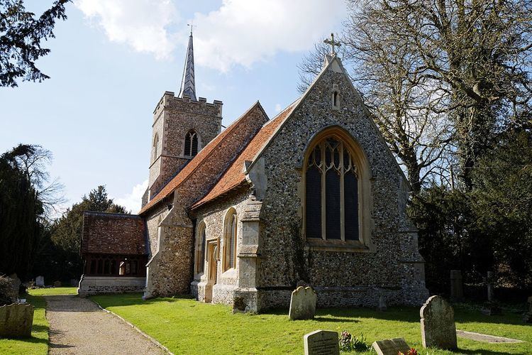
Its name derives from the Abbess of Barking who was a patron of the parish church of St. Edmund in the Middle Ages.
Abbess Roding is located in the west of Essex, 8.4 km (5.2 mi) north of Chipping Ongar, between Harlow in the west and 14.5 km (9.0 mi) from the county town of Chelmsford in the east. The village is in the district of Epping Forest and in the parliamentary constituency of Brentwood & Ongar. The village is served by Abbess Beauchamp and Berners Roding Parish Council.
Abbess Roding recorded in the Domesday Book of 1086-7 as Roinges in the Hundred of Ongar, when it was part of the land of Geoffrey de Mandeville and was held by Geoffrey Martel.
Ab kettleby ab lench abberley abberton abbess roding abbey cwmhir abbey
References
Abbess Roding Wikipedia(Text) CC BY-SA