
Country India Vehicle registration MH-12,MH-14 Area 43 km² Local time Tuesday 5:20 AM | Time zone IST (UTC+5:30) Website www.aambyvalley.com Elevation 700 m Nearest city Lonavla | |
 | ||
Weather 23°C, Wind E at 5 km/h, 30% Humidity | ||
Aamby valley city visual tour
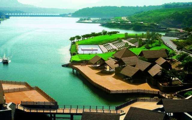
Aamby Valley City is a township developed by the Sahara India Pariwar in Pune district in the Indian state of Maharashtra. It is about 23 km (14 mi) from Lonavala, 87 km (54 mi) from the city of Pune and 120 km (75 mi) from the city Mumbai. The township is connected by road from Lonavala. The township is also connected by air from Mumbai and is equipped with its own airstrip. It has an average annual rainfall of 4,000 mm (160 in) from June to September. The city is spread over 10,600 acres (4,300 ha) of hilly terrain.It is one of Indias best planned city and has been a trendsetter in urban planning and environmental and landscape design . 3 large man made lakes have been created by constructing dams . The largest lake is 1.5 km in length . It also boasts of a PGA 18 hole golf course . This city was designed and master planned by Gruen -Bobby Mukherji & Associates in the year 2003 .