
Year June 2011 | Date June 2011 VEI est. 3-4 | |
 | ||
Type est. Strombolian/Vulcanian/Plinian | ||
The 2011 Nabro eruption was an eruption of the Nabro stratovolcano in the Southern Red Sea Region of Eritrea, which began on 12 June 2011 after a series of earthquakes. The eruption killed seven and possibly a further 31 people and is estimated to be the highest altitude injection of sulfur dioxide (SO2) ever observed by satellite. The Mount Pinatubo eruption 20 years earlier emitted ten times more SO2. The ash cloud from the eruption reached altitudes which disrupted airline traffic in the region. Until the eruption began, the volcano had no records of historical eruptions.
Contents
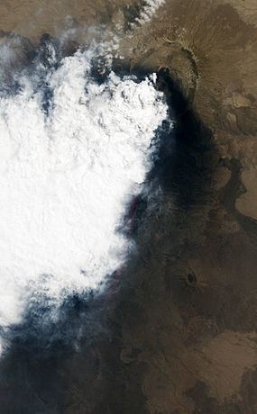
- Map of 2011 Nabro eruption Eritrea
- Eruption
- Other eruptions
- Ash cloud
- Effects
- Geology
- Earthquakes
- References
Map of 2011 Nabro eruption, Eritrea
Eruption
Other eruptions
Small eruptions were also reported in the Afambo and Sireru areas.
Ash cloud
The eruption has ejected a large ash cloud near the Eritrea–Ethiopia border region, extending over 1,000 km (620 mi) into neighboring Sudan.
The height of the ash cloud peaked at 14,000 m, implying a VEI of 3 or 4.
Forecasters predicted correctly that the ash plume might reach Israel, but no flights were cancelled at Ben-Gurion Airport on 14 June. Elsewhere, however, the ash cloud began disrupting air traffic on 14 June with UAE-based Emirates flights being cancelled; flights disruptions extended to other companies the following day. Hillary Clinton, Secretary of State for the United States, shortened her state visit to Ethiopia. Djibouti Airport was closed, and several airlines suspended flights to Ethiopia.
Mek'ele and Asmara were partially covered by volcanic ash.
Effects
On 16 June, the inhabitants of Afambo, Nebro, and Sireru were evacuated.
By 19 June, ash had been deposited at least 60 km (37 mi) beyond the Ethiopian border in a WNW–to–SSW direction.
By 20 June, eight villages in the Biddu district of Ethiopia were covered by volcanic ash, affecting at least 5,000 people and polluting springs and streams. One entire community has not been heard from. Save the Children reports many community members, especially children, are sick and in desperate need of medical attention. Vomiting and retching were reported as being common effects.
On 21 June, an Eritrean government statement reported seven people have been killed and three injured. It was also reported that the Lake Afrera salt deposits now contain sulfuric acid, making the salt inedible.
On 6 July, reports suggest 48,000 people in the Bidu, Afdera, Erebti, Elidar, Teru and Kori woredas were in need of aid (with ash affecting food and water sources), and that the casualty total had reached 31 dead in the Bidu woreda.
Another 167,153 people, in the Elidar and Kori woredas, were reported as requiring monitoring according to the Afar regional government. However a spokesman for the Ethiopean Government Agriculture Ministry is reported to have said "We have looked at the document and I would like to make it clear that it is not a national document and that we have not endorsed it, the ministry has no record of casualties, it is still too early to say how many people had been affected and needed help."
Geology
The erupting volcano is in the Afar Triangle, in the larger Danakil Depression that holds many other active volcanoes. However, neither volcano thought potentially responsible for the eruption had been active in the past century, with Dubbi last erupting in 1861 and Nabro remaining quiet for thousands of years. No eruption of Nabro occurred before in recorded history. Basalt, trachyte and rhyolite are among the rock types which Nabro has produced as lava flows and pyroclastics.
Earthquakes
The 2011 Eritrea–Ethiopia region earthquakes are an ongoing series of moderate earthquakes near a sparsely populated part of the Eritrea–Ethiopia border, starting at 15:37 UTC on Sunday, 12 June 2011. As of 21:37 UTC, at least 19 earthquakes of magnitude 4.5 or greater have occurred in the region. The tremors were associated with this eruption. The initial quake registered a magnitude of 5.1 Mw with a focal depth of 10 km (6.2 mi), and was succeeded by multiple lighter tremors. Hours later, two consecutive magnitude 5.7 Mw earthquakes struck the region at 20:32 and 21:03 UTC, occurring at very similar depths. The latter tremors resulted in localized strong shaking, registering at VII (very strong) on the Mercalli scale near the epicenters. Though no damage has been reported, there is concern over the cause of these earthquakes.