
Area 151 ha | Commune Lyon Arrondissement Lyon | |
 | ||
Intercommunality Urban Community of Lyon | ||
The 1st arrondissement of Lyon, France is one of the nine arrondissements of the City of Lyon. It is located below the hill of Croix-Rousse and on the north part of the Presqu'île formed by the Saône and the Rhône, the two rivers in Lyon
Contents
- Map of 1st arrondissement of Lyon Lyon France
- History
- Area and demographics
- Quarters
- Streets
- Squares and areas
- Administration
- Monuments
- Equipments and services
- Transports
- Cultural activities
- References
Map of 1st arrondissement of Lyon, Lyon, France
This zone is served by the metro lines A and C
History
Les pentes (the slopes Croix-Rousse, which were situated in the Franc-Lyonnais, are integrated to the city of Lyon since 1512, when Louis XII decided to build a fortification on the top of the hill Saint-Sébastien (name of Croix-Rousse in the Middle Ages) to defend the city.
The arrondissement was created the 24 March 1852 (also the date of the creation of the 5 first arrondissements).
Area and demographics
Located in the centre of the presqu'île, the 1st arrondissement is the smallest of all the arrondissements de Lyon. Around the place des Terreaux, bars and pubs across the street make the 1st arrondissement one of the more animated the night and days.
Quarters
The 1st arrondissement of Lyon is composed of four districts :
Streets
Squares and areas
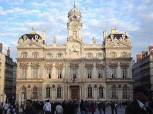
Administration
The city hall is managed since 2001 by Nathalie Perrin-Gilbert (Parti socialiste).