
Area 6.79 km² | Commune Paris Population 186,090 (2011) | |
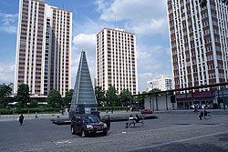 | ||
Exploring parc de la villette the 19th arrondissement of paris vlog 004
The 19th arrondissement of Paris is one of the 20 arrondissements (administrative districts) of the capital city of France.
Contents
- Exploring parc de la villette the 19th arrondissement of paris vlog 004
- Map of 19th arrondissement Paris France
- Geography
- Demographics
- Places of interest
- References
Map of 19th arrondissement, Paris, France
Situated on the Right Bank of the River Seine, it is crossed by two canals, the Canal Saint-Denis and the Canal de l'Ourcq, which meet near the Parc de la Villette.
The 19th arrondissement includes two public parks: the Parc des Buttes Chaumont, located on a hill, and the Parc de la Villette, which is home to both the Cité des Sciences et de l'Industrie, a museum and exhibition centre, and the Conservatoire de Paris, one of the most renowned music schools in Europe and part of the Cité de la Musique.
Geography
The land area of the arrondissement is 6.786 km2 (2.62 sq. miles).
Demographics
The population of the 19th arrondissement is still increasing. At the last census, in 1999, the population was 172,730 inhabitants. As of the same census, 68,101 people worked in the arrondissement.
This sector has become the home for many immigrants to France, particularly from North Africa.