
Formed August 18, 1927 Fatalities 173-192+ | Dissipated August 29, 1927 Highest winds 201 km/h | |
 | ||
Lowest pressure 950 mbar (hPa); 28.05 inHg Damage $1.6 million (1927 USD) Date 18 August 1927 – 29 August 1927 Affected areas | ||
The 1927 Nova Scotia hurricane (also known as the 1927 Great August Gale or the Great Gale of August 24) was a powerful Category 3 hurricane that struck the Canadian province of Nova Scotia in mid-August 1927. The first observed tropical cyclone of the season, this cyclone developed from a tropical wave over the deep tropics of the Atlantic Ocean on August 18. Initially a tropical storm, it moved west-northwestward and intensified into a Category 1 hurricane on the modern day Saffir–Simpson hurricane wind scale by August 19. The storm deepened significantly over the next few days, and by August 22, it peaked as a Category 3 hurricane with maximum sustained winds of 125 mph (205 km/h). Around that time, the system began curving northwestward and later northward. By August 23, it turned to the north-northeast and then began weakening on August 24. Thereafter, the storm accelerated toward Atlantic Canada. Late on August 24, the hurricane struck near Yarmouth, Nova Scotia, as a Category 2 hurricane, just before becoming extratropical.
Contents
In New England, rainfall caused minor street flooding, especially in central Massachusetts and Maine, where 2.09 inches (53 mm) of precipitation fell in the city of Portland. Of the 173-192 fatalities in Canada, most of them occurred due to damaged or missing ships, with two boats losing their entire crew. On land, Nova Scotia was impacted most significantly. Heavy rainfall washed out 20–25 percent of the rail lines, which disrupted rail service. Flooding also damaged numerous roads and swept away bridges making traveling difficult. Crop damage from the hurricane was severe as the storm destroyed about half of the fruit, vegetable, and hay harvest, leaving a loss of $1 million. Property damage in the province was in the thousands of dollars range and there were many electrical and telephone service outages. Similar but less severe impact occurred in New Brunswick and Prince Edward Island. The storm also left minor wind damage in Newfoundland. Overall, the hurricane caused just under $1.6 million in damage.
Storm history
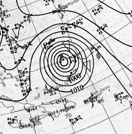
A possible Cape Verde type hurricane, the storm was detected on August 21, 300 miles (480 km) east of the Leeward Islands (it had already reached hurricane status on August 19). Warmer waters in the Atlantic Ocean allowed the hurricane to rapidly reach Category 3 status on August 22 and a ship reported a barometric pressure of 28.06 inches (950 millibars). The hurricane moved northwestward at a speed of 25 mph (40 km/h) before recurving on August 23. With the center 100 miles (161 km) east of North Carolina, the hurricane moved northeast where it bypassed Nantucket by 100 miles (161 km). The hurricane then made landfall in Nova Scotia on August 24 as a strong extratropical storm with 100 mph (161 km/h) winds. Later the extratropical remnants of the hurricane were tracked as far north as Iceland.
Preparations
Shipping ahead of the hurricane received repeated warnings broadcast by both American and Canadian weather officials. Small craft warnings and a hurricane warning for New York City were also issued. However, the majority of fishing vessels in Atlantic Canada in this period did not have radios, leaving the large fishing fleet on the offshore banks unaware of the approaching disaster.
Impact
Because of the fast forward speed of the hurricane, the damage was minimal in New England. However, the hurricane was devastating in Atlantic Canada as the storm caused tremendous damage and 184 deaths, most of which were at sea. The hurricane's impact was the worst for Atlantic Canada in over a half a century.
New England
Rainfall from the hurricane caused moderate flooding in New England. Most of the flooding occurred in central Massachusetts. In Maine, dense fog was reported and rainfall up to 2 inches (50.8 mm) fell across the state. The rainfall caused isolated street flooding. In Eastport, Maine a weather station reported a low pressure of 983 mbar (29.0 inHg). Offshore, the hurricane damaged a fishing ship leaving one dead and three injured.
Atlantic Canada
Nova Scotia received heavy rainfall up to 4 in (102 mm) and gale force winds. The hardest hit area was Harbourville and adjacent settlements along the "Bay Shore" coastline of the Bay of Fundy. There the hurricane completely destroyed a gravel road which had been built shortly before the storm's impact. Another road connecting to a hotel was also severely damaged. Heavy rainfall brought by the hurricane caused landslides and flooding along the Harbourville Mountain which washed out numerous roads. In the Annapolis Valley, the rainfall fell so quickly that drainage ditches and small creeks overflowed. In Lakeville, flooding washed away a 25-foot (7.6 m) bridge, and fallen trees and other storm debris littered the streets and roads. The Cornwallis River overflowed its banks, causing serious flash flooding. Near Harrington’s Crossing, a small creek overflowed its banks, stalling numerous automobiles. Roads were extensively impacted in Digby, Wolfville, Yarmouth, and Annapolis County, which suffered $150,000 in damage to streets alone. Overall, there was about $500,000 in damage to roads in Nova Scotia.
In Halifax, wind gusts of 48 mph (77 km/h) were observed, damaging a grain elevator. Heavy rainfall washed out the railroad lines between Halifax and Yarmouth. A power plant in Pictou County suffered $500 in damage after the roof blew off. In Springhill, strong winds downed trees, fences, and houses. A warehouse in Sydney was destroyed after being tossed about 50 ft (15 m) by the wind. Throughout Nova Scotia, flooding washed out 20–25 percent of the rail lines across Nova Scotia, disrupting rail service. Flooding also damaged numerous roads and swept away bridges making traveling difficult. Crop damage from the hurricane was severe as the storm destroyed 50 percent of the fruit, vegetable, and hay harvest, leaving a loss of $1 million. Other parts of Nova Scotia received similar damage. Overall, property damage in the province was in the thousands of dollars range and there were many electrical and telephone service outages.
Wind gusts in Newfoundland as strong as 90 mph (140 km/h) at the Corner Brook subdivision of Curling caused about $500 in damage to circus tents and associated equipment. In New Brunswick, precipitation peaked at 3.3 in (84 mm) in Saint John. A car tumbled into washed out culvert in Horseman's Hill, injuring three people. Several bridges and culvert were destroyed in Springhill. A dam broke near University of St. Joseph's College, severely flooding the campus and demolishing the gymnasium. Throughout the province, streets, bridges, gardens, and crops, particularly hay and grain, were damaged, while railroad lines were destroyed. Power outages and loss of telephone services were common. Damage in New Brunswick totaled at least $51,000. In Prince Edward Island, 2 in (51 mm) of rain fell in Charlottetown and winds of 30 mph (45 km/h) were observed. The city was littered with debris. Generally minor street flooding occurred. Fruit trees and crops suffered extensive damage. At the exhibition grounds, buildings and fences received about $1,000 in damage.
Offshore, seventy-five fishing boats of the Lunenburg fishing fleet were reported missing in the Grand Banks. Of the seventy-five, four vessels were reported as total losses. The Joyce Smith and Clayton Walters were the first two fishing vessels to fall victim to the hurricane. The Joyce Smith was carrying 22 men (mostly from Newfoundland) and it and the Walters were fishing off the coast of Sable Island at the time of the hurricane. The last sighting of the two fishing boats was from the crew of the Marshall Frank 27 mi (43 km) off Sable Island. Newspaper reports suggested that both fishing boats did not survive the storm and all 43 crewmen perished at sea. The Mahala, another fishing schooner, was also listed among the ships missing after the hurricane. A search in the area where the ship was reported missing turned up nothing and it was assumed that the ship sank along with its eighteen fishermen. The fourth fishing boat to be reported missing was the Uda R. Corkum which was carrying a crew of 21 crew men and 1800 quintals of fish. In all, the loss from all four vessels totaled up to 80 and monetary losses from all four ships totaled over $100,000. Four more fishing boats also sank, taking 33 lives. In addition to the Canadian fishing boats, the famous U.S. racing and fishing schooner Columbia carrying 22 crew men (many from Nova Scotia) sank during the storm off the coast of Sable Island. There were no survivors.
The Nova Scotia hurricane of 1927 followed another tragic August storm the previous year and together they became known as "The August Gales", remembered for generations as one of the worst tragedies in the fisheries of Maritime Canada. The severe shipping losses, especially among banks fishing schooners, accelerated a move to outfit Canadian schooners with motors and radios. Today the Hurricane of 1927 is commemorated in a waterfront monument and an exhibit at the Fisheries Museum of the Atlantic in Lunenburg, Nova Scotia.