
Car plates FZA Capital Żary | Seat Żary Area 1,393 km² | |
 | ||
Gminas Total 10 (incl. 2 urban)ŁęknicaŻaryGmina BrodyGmina JasieńGmina Lipinki ŁużyckieGmina LubskoGmina PrzewózGmina TrzebielGmina TupliceGmina Żary Points of interest Rodzinny Park Linowy, Rezerwat kulturowy "Park Mu, Park przypałacowy, Baszta Pachołków, Trasa Geoturystyczna „Dawna K | ||
Żary County (Polish: powiat żarski) is a unit of territorial administration and local government (powiat) in Lubusz Voivodeship, western Poland, on the German border. It came into being on January 1, 1999, as a result of the Polish local government reforms passed in 1998. Its administrative seat and largest town is Żary, which lies 43 km (27 mi) south-west of Zielona Góra and 123 km (76 mi) south of Gorzów Wielkopolski. The county contains three other towns: Lubsko, lying 21 km (13 mi) north-west of Żary, Jasień, lying 16 km (10 mi) north-west of Żary, and Łęknica, 30 km (19 mi) west of Żary.
Contents
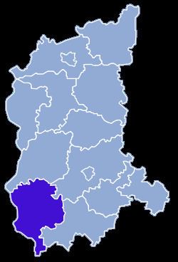
Map of %C5%BBary County, Poland
The county covers an area of 1,393.49 square kilometres (538.0 sq mi). As of 2006 its total population is 98,929, out of which the population of Żary is 38,967, that of Lubsko is 14,767, that of Jasień is 4,526, that of Łęknica is 2,641, and the rural population is 38,028.
Neighbouring counties
Żary County is bordered by Krosno Odrzańskie County to the north, Zielona Góra County to the north-east, Żagań County to the east and Zgorzelec County to the south. It also borders the German states of Saxony and Brandenburg to the west.
Administrative division
The county is subdivided into 10 gminas (two urban, two urban-rural and six rural). These are listed in the following table, in descending order of population.