
Admin. region Köln Elevation 110 m (360 ft) Local time Sunday 7:05 AM | Time zone CET/CEST (UTC+1/+2) Population 24,779 (31 Dec 2010) | |
 | ||
Weather 7°C, Wind SW at 10 km/h, 88% Humidity Points of interest Naherholungsgebiet Wurmtal, Willy‑Dohmen Park, Schloss Zweibrüggen | ||
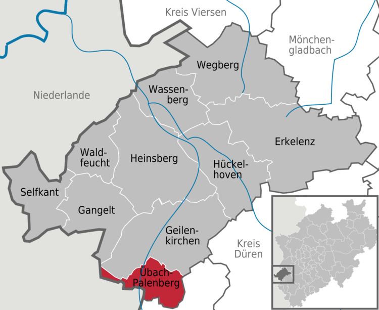
Übach-Palenberg is a town in the Heinsberg district of North Rhine-Westphalia, Germany.
Contents
- Map of 52531 C39Cbach Palenberg Germany
- Geography
- History
- International relations
- Coat of arms
- Economy
- References
Map of 52531 %C3%9Cbach-Palenberg, Germany
Geography
The town is located at the border with the Netherlands, at approx. 10 km east of Heerlen and 15 km north of Aachen. The river Wurm flows through the area. The town has an area of 26.106 km². More than half the area is agricultural.
History
International relations
Übach-Palenberg has two twin towns; since 1989 with Rosny-sous-Bois, (France) and since 1999 neighbouring Landgraaf, (Netherlands).
Coat of arms
The coat of arms of the town is subdivided into three fields. In the top blue field are two crossed golden scepter with a lily head, with a black letter T on top. Both symbols refer to the Grundherrschaft Thorn. In the left golden field is a black lion, the symbol of Jülich, as both Frelenberg and Palenberg belonged to the county Jülich. To the right is a silver lion on a red field, the symbol of Heinsberg, where Scherpenseel belonged to historically. The coat of arms were granted on December 2, 1937 by the Oberpräsident of the province Rhineland.
Economy
In addition to international companies such as SLV, Neuman & Esser, Schlafhorst or Spanset the company Solent GmbH & Co. KG produces chocolate, nuts and dried fruit for various brands in Übach-Palenberg since 2010. The sister company Bonback GmbH & Co. KG produces at the same location as a wholesale bakery.