
Max. depth 217 m (712 ft) Volume 1.2 km³ | Surface area 11 km (4.2 sq mi) Area 11 km² | |
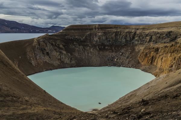 | ||
Öskjuvatn is a lake in the Highlands of Iceland. Its surface area is about 11 km². With a depth of 217 m (712 ft), it is the second deepest lake in Iceland after Jökulsárlón.
Map of Lake Askja, Iceland
The lake is situated in the crater of the volcano Askja in the north-east of the glacier Vatnajökull. Its name simply means the lake of Askja. Like the neighbouring crater Víti, it was created by an enormous volcanic eruption in 1875.
On July 10, 1907, two German scientists, Walter von Knebel and Max Rudloff disappeared while exploring the lake in a small boat. Knebel's fiancée, Ina von Grumbkow, led an expedition in search of them with a vulcanologist Hans Reck, but no trace of them was ever found. Suppositions at the time suggested that seismic volcanic disturbances could have caused a landslip or similar occurrence, and recorded that only two days previously the telegraph cable to Iceland had been broken by deep water disturbances for the first time since it was laid, close to the Icelandic coast.