
Location Indian Ocean Highest elevation 473 m (1,552 ft) District Îles Kerguelen Area 45.8 km² | Archipelago Îles Kerguelen Highest point unnamed Elevation 473 m Max length 13 km | |
 | ||
Coordinates 48° 55′ 32″ S 69° 10′ 46″ E | ||
Île Saint-Lanne Gramont is an uninhabited island, the fourth largest island in the Kerguelen Islands, situated to the north of presqu'île de la Société de géographie, with an area of 45.8 km². It reaches 480 m at its highest point and is located at 48°55′25″S 69°10′54″E. The island is elongated along a north-south axis, reaching a maximum length of 13 km and a maximum width of 3 km. It is free of introduced animals.
Contents
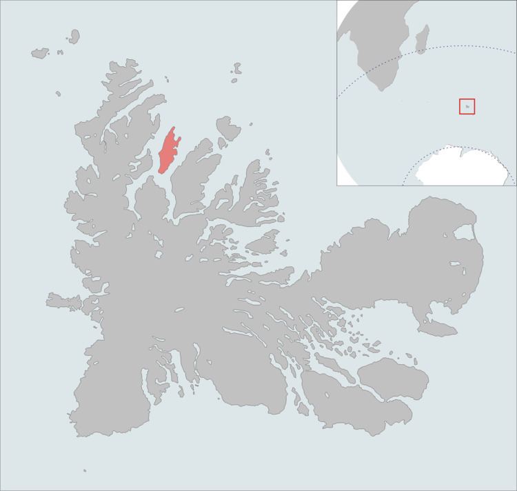
Map of Saint-Lanne Gramont Island, French Southern and Antarctic Lands
Important Bird Area
The island, along with the neighbouring, and relatively large, islands of Île Foch and Île Howe, as well as the smaller Île MacMurdo, Île Briand, Îles Dayman and Îlots Hallet, has been identified by BirdLife International as an Important Bird Area (IBA) because of its value as a breeding site, especially for seabirds, with at least 29 species nesting in the IBA.