
Location Indian Ocean Highest elevation 687 m (2,254 ft) District Îles Kerguelen Area 206 km² | Archipelago Îles Kerguelen Highest point Pyramide mexicaine Elevation 687 m Max length 28 km | |
 | ||
Coordinates 48° 59′ 39″ S 69° 16′ 42″ E | ||
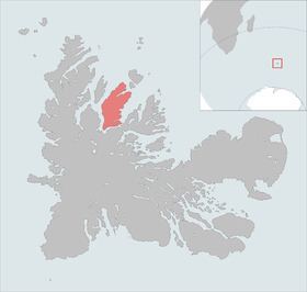
Île Foch is one of the Kerguelen Islands situated near to the north coast of Grand Terre, the principal island.
Contents
Map of Foch Island, French Southern and Antarctic Lands
It is separated from this main island only by a narrow sea arm, the Tucker strait. It borders île Saint-Lanne Gramont at the northwest, which is separated by the Baie de Londres. At the northeast point it borders Mc Murdo and Howe
It is the second largest island in the archipelago (206 km²). The highest point is named la Pyramide Mexicaine, at 687 metres.
Protected area
Since it is the largest island in the archipelago with no introduced species (no rabbits, cats, mice or rats), Île Foch is used as a reference as to the original ecosystem of Kerguelen Island. To prevent any accidental introduction of species, access is highly regulated and restricted to scientific missions only.
Important Bird Area
The island, along with the neighbouring, and relatively large, islands of Île Saint-Lanne Gramont and Île Howe, as well as the smaller Île MacMurdo, Île Briand, Îles Dayman and Îlots Hallet, have been identified by BirdLife International as an Important Bird Area (IBA) because of its value as a breeding site, especially for seabirds, with at least 29 species nesting in the IBA.