
Time zone CET (UTC+1) Area 41.6 km² | Canton Saulzais-le-Potier INSEE/Postal code 18089 /18360 Population 414 (1999) | |
 | ||
Épineuil-le-Fleuriel is a commune in the Cher department in the Centre region of France.
Contents
Map of 18360 %C3%89pineuil-le-Fleuriel, France
Geography
An area of lakes, streams and farming consisting of the village and several hamlets situated by the banks of both the river Cher and the canal de Berry, some 37 miles (60 km) south of Bourges at the junction of the D4, D64 and the D97 roads. The A71 autoroute runs through the western part of the territory of the commune and it shares a border with the department of Allier.
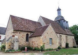
Sights
Personalities
References
Épineuil-le-Fleuriel Wikipedia(Text) CC BY-SA