
Elevation 1,000 m (3,280 ft) Postal code 51910 Population 1,254 (2011) | District Ulukışla Time zone EET (UTC+2) Licence plate 51 Area code 0388 | |
 | ||
Çiftehan is a belde (town) in Niğde Province, Turkey
Contents
- Map of 51900 C387iftehan BucaC49FC4B12FUlukC4B1C59Fla2FNiC49Fde Turkey
- Geography
- History
- Economy
- References
Map of 51900 %C3%87iftehan Buca%C4%9F%C4%B1%2FUluk%C4%B1%C5%9Fla%2FNi%C4%9Fde, Turkey
Geography
Çiftehan is a part of Ulukışla district which in turn is a part of Niğde Province. It is in the Toros Mountains at an altitude of about 1,000 m (3,300 ft), north of the main passage of the mountain system known as Cilician Gates (Turkish: Gülek Boğazı). At 37°31′N 34°11′E, it is 30 km (19 mi) east of Ulukışla and 80 km (50 mi) south of Niğde. The population is 1254 as of 2011.
History
The vicinity was the southern gate of the Roman Province, Cappadocia . The thermal baths around were famous during Roman Empire era and according to unproven claims Cleopatra VII of Ptolemaic Egypt also visited the baths. The spa pools constructed by the Seljuk Turks (11th century-13th century) still survive. But there were no permanent settlements. The village was formed as recently as the first half of the 20th century and after the rapid increase of population the village was declared town.
Economy
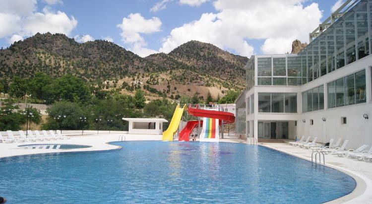
Because of intense forests around Çiftehan, the agricultural income is low. The main economic activity of the town is domestic tourism based on hot springs. There are many spa hotels. The advantage of the town is its location on the state road connecting Central Anatolia to Mediterranean Region.