
Local time Sunday 5:44 PM | Population (1 oktober 2008) 4,735 | |
 | ||
Weather 15°C, Wind NW at 18 km/h, 63% Humidity | ||
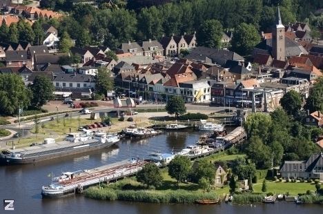
Zwartsluis is a small city in the Dutch province of Overijssel. It is located in the municipality of Zwartewaterland, at the mouth of the Zwarte Water River and the Meppelerdiep canal.
Map of Zwartsluis, Netherlands
The town is home to many recreational boats, as well as a heritage fleet of fishing and cargo vessels. The Arembergergracht links the town with the Beulaker and Belter lakes and a multitude of smaller bodies of water just north, created by peat digging.
Zwartsluis's history started in the Eighty Years' War (1568-1648) - it developed around Fortress Swartersluys which controlled traffic on the Zwartewater inlet leading to Hasselt and Zwolle. Zwartsluis attracted some trade and a fishing fleet in later centuries. Zwartsluis also served as consolidation point for the peat-fuel trade, but was surpassed in importance by its neighbours, especially downstream Genemuiden.
Zwartsluis was a separate municipality until 2001, when it became a part of Zwartewaterland.