
Country India Seat Zunheboto ISO 3166 code IN-NL-ZU Population 300,000 (2011) | State Nagaland Time zone IST (UTC+05:30) Area 1,255 km² | |
 | ||
Website | ||
Zunheboto (Pron:/ˌzʌnˈhiːbəʊtəʊ/) is a district of Nagaland state in India.
Contents
Map of Zunheboto, Nagaland
Geography
It is bordered on the north by Mokokchung district, Kohima district and Wokha district on the west, Phek district in the south, and Tuensang district and Kiphire district in the east. Headquarters is at Zunheboto. A hilly place, Zunheboto is covered by evergreen forests and surrounded by small streams and rivers. It is home to Satoi Range, surrounded by 10 villages of Satakhasub-division, which is one of the paradise for ornithologists and bird-watchers. This range comes under Important Bird Area as well as Endemic Bird Area of India. Many endangered species like Blythi Tragopan, Kalij Pheasent and Peacock Pheasent are still seen in this range.
Demographics
According to the 2011 census, Zunheboto district has a population of 300,000, roughly equal to the nation of Saint Lucia. This gives it a ranking of 598th in India (out of a total of 640). Zunheboto has a sex ratio of 981 females for every 1000 males, and a literacy rate of 86.26%.
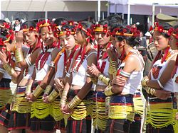
Zunheboto is the home to the Sumi Nagas, a warrior tribe of Nagaland. Head hunting was practiced extensively until the advent of the Christian missionaries who converted the warriors to Christianity. Today the people are peaceful and hardworking, practicing agriculture as their main occupation.
Education
Today it is home to the Nagaland University whose campus is situated in the village of Lumami in the sub division of Akuluto. This has become the cultural center for the people of Nagaland, as all the Nagas irrespective of tribes come to study here.