
Time zone CET/CEST (UTC+1/+2) Population 17,477 (31 Dec 2008) | Elevation 38 m (125 ft) Postal codes 15806 Local time Sunday 12:28 PM | |
 | ||
Weather 17°C, Wind NW at 16 km/h, 62% Humidity Points of interest Garnisonsmuseum Wünsdorf, Jägersberg‑Schirknitzberg, Naturschutzgebiet Großer und Westufer, Lost Place, Winkelturm | ||
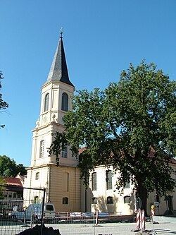
Zossen (Upper Sorbian: Sosny) is a German town in the district of Teltow-Fläming in Brandenburg, approximately 20 miles (30 km) south of Berlin, and next to the B96 highway. Zossen consists of several smaller municipalities, which were grouped together in 2003 to form the city.
Contents
Map of Zossen, Germany
Geography
Since the 2003 municipal reform, Zossen consists of the following districts and municipalities:
History
Zossen, like most places in Brandenburg, was originally a Slavic settlement. Its name may derive from Sosna meaning pine, a tree quite common in the region.
In 1875 Zossen station opened at the railway line from Berlin to Dresden and the Prussian military railway to the artillery range at Kummersdorf-Gut in present-day Am Mellensee. Between 1901 and 1904, Zossen adopted the use of different high-speed vehicles, such as electric locomotives and trams, for transportation to and from Berlin-Marienfelde. These vehicles were powered by an alternating current of 15kV and used a variable frequency. The power was transmitted by three vertical overhead lines.
In 1910 a proving ground and a garrison of the Imperial German Army was established at the Waldstadt section of the Wünsdorf community and also until now it is still established. In World War I it was the site of several prisoner-of-war camps, including the "crescent camp" (Halbmondlager) for Muslim fighters of the Triple Entente, where the first wooden mosque in Germany was erected. From 1939 to 1945, Wünsdorf hosted the underground headquarters of the German Wehrmacht (OKW) and Army's High Command (OKH). After World War II the area was the site of a Soviet military camp, the largest outside Russia, until 1990. Since then has been returned to civilian use as the Wünsdorf-Waldstadt book town.