
Time zone China Standard (UTC+8) Area 10,620 km² Province Sichuan County seat Dazhasi (达扎寺镇) | Postal code 624500 Prefecture-level city Ngawa Area code 0837 Points of interest Huahu Scenic Area | |
 | ||
Country People's Republic of China | ||
Zoigê County (Tibetan: མཛོད་དགེ་རྫོང༌།, Wylie: mdzod dge rdzong, Chinese: 若尔盖县; pinyin: Ruò'ěrgài Xiàn) is a county of Ngawa Tibetan and Qiang Autonomous Prefecture, Sichuan province, China, bordering Gansu to the north. It is the northernmost county of the province. It is part of Tibetan traditional part called Amdo.
Contents
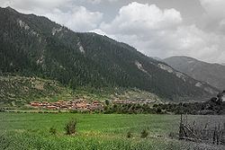
Map of Zoige, Aba, Sichuan, China
It has an area of 10,620 km2 (4,100 sq mi) and 69,900, 90.4% of which are Tibetan people.
Geography
Zoigê County is found in the easternmost sections of the Qinghai Plateau. The county is primarily a highland basin made up of the Zoigê Marshes between the Min Mountains and Ani Maching Mountains. The western border of the county, shared with Maqu County in Gansu, is formed by the first major bend of the Yellow River where it changes course nearly 180 degrees and heads back towards Qinghai.
Climate
Zoigê has an alpine subarctic climate (Köppen Dwc), featuring very cold nights even in summertime, and very cold winters with extreme diurnal temperature ranges. Snow can fall any time of the year and usually does not melt until summer due to repeated nightly freezing even when maxima are above 0 °C (32 °F). Therefore, access to Zoigê is heavily restricted during the winter months from late October to early May. Sitting at an altitude of more than 11,000 feet, high-altitude sickness is another common problem for tourists.
Transport
Administrative divisions
Zoigê County has 2 town and 15 townships: