
Country China Time zone China Standard (UTC+8) Area 40.1 km² Local time Monday 4:19 AM | Sub-provincial city Dalian 2 Xigang Province Liaoning | |
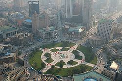 | ||
Seat No. 83 Yide Street (一德街83号) Dalian district map Subdivisions of Dalian, Liaoning
1
2
3
4
5
6
7
8
9
10
Core
1
Zhongshan
2
Xigang
3
Shahekou
4
Ganjingzi
Suburban
5
Lüshunkou
6
Jinzhou
9
Pulandian
Satellite
8
Wafangdian
10
Zhuanghe
Rural
7
Changhai Co. Weather 8°C, Wind E at 3 km/h, 38% Humidity Points of interest Zhongshan Square, Victory Square, Haizhiyun Park, Bird Singing Woods, Bangchui Island Scenic Ar | ||
Zhongshan District (simplified Chinese: 中山区; traditional Chinese: 中山區; pinyin: Zhōngshān Qū) is one of the seven districts of Dalian, Liaoning province, People's Republic of China, forming part of the urban core. Its area is 40.10 square kilometres (15.48 sq mi) and its permanent population as of 2010 is 339,527.
Contents
Map of Zhongshan, Dalian, Liaoning, China
Administrative divisions
There are 9 subdistricts within the district.
Subdistricts:
Education
International schools include:
The following secondary schools are within Zhongshan District:
The following universities are within Zhongshan District:
References
Zhongshan District, Dalian Wikipedia(Text) CC BY-SA