
Time zone CET (UTC+1) Area 6.87 km² Area code 45 | County Szabolcs-Szatmár-Bereg Postal code 4625 Local time Sunday 7:32 PM | |
 | ||
Weather 19°C, Wind SE at 3 km/h, 29% Humidity | ||
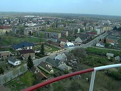
Záhony (Ukrainian: Загонь) is a town in Szabolcs-Szatmár-Bereg county, in the Northern Great Plain region of eastern Hungary.
Contents
Map of Z%C3%A1hony, 4625 Hungary
It covers an area of 6.97 km2 (3 sq mi) and has a population of 4675 people (2005). It is near the Ukrainian border and was part of Ung county before Trianon Treaty. Road and railway border crossings into Ukraine are located here. The Ukrainian town across the border is Chop.
Twin towns — Sister cities
Záhony is twinned with:
References
Záhony Wikipedia(Text) CC BY-SA