
Time zone GMT +5 (UTC+5) Population 132,759 (2009) | Area 2,415 km² Local time Sunday 6:04 AM | |
 | ||
Weather 3°C, Wind SE at 10 km/h, 55% Humidity | ||
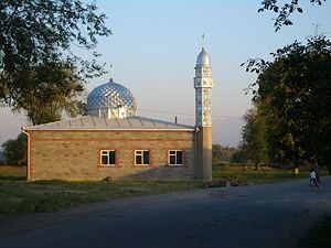
Ysyk-Ata District (Russian: Ысык–Атинский район) is one of the eight districts of the Chuy Region in northern Kyrgyzstan. Its area is 2,415 square kilometres (932 sq mi), and its resident population was 132,759 in 2009. The administrative center of the district is the city of Kant (population 21,589 in 2009), and the district itself was known as Kant District in the past. The district is located on the southern side of the Chui River, about halfway between the national capital Bishkek and the former provincial capital Tokmok.
Contents
- Map of Ysyk Ata Kyrgyzstan
- Air force base and school
- Water erosion
- Demographics
- Ethnic composition
- Populated places
- References
Map of Ysyk-Ata, Kyrgyzstan
Air force base and school
In 1941, a Soviet Air Force base and pilot training school were set up in the district. During World War II, 1507 military pilots were trained there. Since 1956, the school trained foreign pilots; among its graduates were both the ex-Egyptian president Hosni Mubarak and the late Syrian president Hafez Assad.
In 1992, the air base was transferred to Kyrgyzstan authorities; since 2003 it hosts Russian Air Force units.
Water erosion
The district authorities, as well as the residents of the riverside village of Milianfan (Russian: Милянфан), are concerned with the River Chui gradually washing away the district's land, as it shifts its course to the south and erodes its left (southern) bank.
Demographics
As of 2009, Ysyk-Ata District included 1 town, and 58 villages in 18 rural communities (aiyl okmotus). Its de facto population, according to the Population and Housing Census of 2009, was 131,503, and de jure population 132,759. Some 21,762 people live in urban areas, and 109,741 in rural ones.
Ethnic composition
According to the 2009 Census, the ethnic composition of the Nookat District (de jure population) was:
Populated places
- city Kant
- Ak-Kuduk aiyl okmotu (center - village Kirovskoye, and also villages Ak-Kuduk, Kotovskoye, Pervomayskoye, Khun Chi (partly))
- Birdik aiyl okmotu ( center - village Birdik, Khun Chi (partly))
- Ivanovka aiyl okmotu (center - village Ivanovka)
- Jeek aiyl okmotu (center - village Dmitriyevka, and also villages Imeni Gagarina, Jeek)
- Internatsionalnyi aiyl okmotu (center - village Internatsionalnoye, and also village Jar-Bashy)
- Keng-Bulun aiyl okmotu (center - village Keng-Bulun, and also villages Gidrostroitel, Druzhba, Cholpon)
- Kochkorbaev aiyl okmotu (center - village Kengesh and also villages Budennovka, and Dokturbek Kurmanaliev)
- Krasnorechenskiy aiyl okmotu (center - village Krasnaya Rechka)
- Logvinenko aiyl okmotu (center - village Novopokrovka (partly), and also village Chong-Daly)
- Lyuksemburg aiyl okmotu (center - village Lyuksemburg, and also village Kirshelk)
- Milyanfan aiyl okmotu (center - village Milyanfan)
- Novopokrovka aiyl okmotu (center - village Novopokrovka (partly), and also village Leninskoye, Sary-Jon)
- Nurmanbet aiyl okmotu (center - village Nurmanbet, and also villages Pervomayskoye, Imeni Aliaskara Toktonalieva)
- Syn-Tash aiyl okmotu (center - village Imeni Telmana, and also villages Ak-Say, Jetigen, Kyzyl-Aryk, Otogon, Rot-Front, Sovetskoye, Syn-Tash)
- Tuz aiyl okmotu (center - village Tuz, and also villages Dayyrbek, Jayalma, Nizhnyaya Serafimovka)
- Uzun-Kyr aiyl okmotu (center - village Jer-Kazar, and also villages Druzhba, Nizhniy Norus)
- Yurevka aiyl okmotu (center - village Yuryevka and also village Ysyk-Ata)
- Ysyk-Ata aiyl okmotu (center - village Almaluu, and also villages Gornaya Serafimovka, Jogorku-Ichke-Suu, Ichke-Suu, Karagay-Bulak, Norus, Tash-Bashat, Toguz-Bulak, Üch-Emchek)