
Elevation 564 m | OS grid SH364447 Prominence 433 m Topo map OS Landranger 123 Listing Marilyn | |
 | ||
Translation The forks. Also known as The Rivals as it sounds similar to 'yr Eifl' (Welsh) Similar Carn Fadryn, Gyrn Ddu, Garn Boduan, Bwlch Mawr, Mynydd Mawr | ||
Lleyn peninsula a guided walk to tre r ceiri and yr eifl
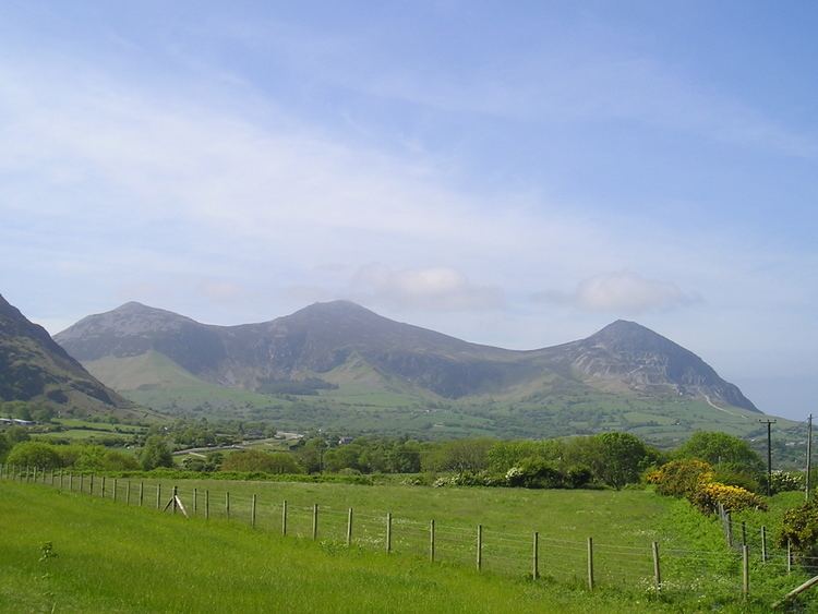
Yr Eifl is a group of mountains on the north coast of the Llŷn Peninsula in Gwynedd, Wales.
Contents
- Lleyn peninsula a guided walk to tre r ceiri and yr eifl
- Map of Yr Eifl Pwllheli UK
- The three peaks
- Surroundings
- References
Map of Yr Eifl, Pwllheli, UK
It has three summits, each quite separate from the others, and this is often supposed to be the source of the English name The Rivals. But this is merely an anglicised form of Yr Eifl, meaning "the forks" or "the strides" (Welsh: gafl, plural geifl).
On a clear day, the views from the top summit reach as far as the Isle of Man, the Wicklow mountains in Ireland and the Lake District, as well as the entire sweep of Cardigan Bay.
The view of Yr Eifl is especially striking from the SW coast of Anglesey, for instance from Ynys Llanddwyn.
The OS Maps show a height of 564 metres, but a recent survey gives the height at 561 metres (1,841 feet).
The three peaks
There are three peaks:
Garn Ganol, the central summit, is the highest point on Llŷn, with an ancient cairn, and it houses the trig point;
Across the pass "Bwlch yr Eifl", and overlooking the sea, is Garn Fôr, the northern summit. It has a microwave radio relay station on it, as well as cairns and granite quarries (producing the material for the curling event at the 2006 Winter Olympics), and a cliff face leading down to the Irish Sea.
The third summit, Tre'r Ceiri, on the south-eastern side, is the location of an Iron Age hillfort. Its name means "town of the giants", from cewri, plural of cawr, giant. It is regarded as one of the best examples of a prehistoric hillfort in Europe. A path leads to the summit.
Surroundings
Routes lead onto the hill from the nearby villages of Llithfaen to the south, Llanaelhaearn to the east and Trefor to the north. On the western slopes of Yr Eifl, beneath Graig Ddu (a cliff on the western slope of Garn Ganol), a small valley leads down to the sea. This is Nant Gwrtheyrn ("Vortigern's Valley"), a valley with no public roads, with a former quarry village, which is now home to a Welsh-language teaching centre.
Another quarry, Trefor granite quarry, can be found to the north of Garn Ganol.