
Vehicle registration ΜΙ | Time zone EET (UTC+2) Local time Sunday 2:10 AM | |
 | ||
Weather 7°C, Wind NW at 2 km/h, 69% Humidity | ||
Ypati (Greek: Υπάτη) is a village and a former municipality in Phthiotis, Greece. Since the 2011 local government reform it is part of the municipality of Lamia, of which it is a municipal unit. The municipal unit has an area of 257.504 km2. Its 2011 population was 4,541 for the municipal unit, and 496 for the settlement of Ypati itself. The town has a long history, being founded at the turn of the 5th/4th century BC as the capital of the Aenianes. During the Roman period the town prospered and was regarded as the chief city of Thessaly, as well as a bishopric. It was probably abandoned in the 7th century as a result of the Slavic invasions, but was re-established by the 9th century as Neopatras. The town became prominent as a metropolitan see and was the capital of the Greek principality of Thessaly in 1268–1318 and of the Catalan Duchy of Neopatras from 1319 to 1391. It was conquered by the Ottomans in the early 15th century and remained under Ottoman rule until the Greek War of Independence.
Contents
- Map of Ypati 350 16 Greece
- Geography
- Antiquity
- Byzantine medieval and Ottoman eras
- Revolutionary period
- Modern era
- Subdivisions
- Monuments and sights
- References
Map of Ypati 350 16, Greece
Geography
Ypati is around 30 km west of Thermopylae and north of the Oiti mountains and Xerisa river, it is also 25 km west of Lamia south of the GR-38 (Lamia - Karpenissi - Agrinio), around 230 km NNW of Athens and about 50 km east of Karpenissi, it overlooks the Spercheios to the north. The geography includes forests and grasslands to the south in higher elevations. Phocis lies to the south. Around 3 km northwest are the famous springs which dates to the ancient times. It is around a few kilometres from the mountains.
Antiquity
In Antiquity, the city was known as Hypate (Ὑπάτη) or Hypata (Ὑπάτα), probably a corruption of hypo Oita (ὑπὸ Οἴτα, meaning "near the Mount Oeta").
The city was founded in the late 5th/early 4th century, as the capital of the Aenianes tribe and their koinon ("league, commonwealth"). In later times it belonged to the Amphictyony of Amphela. Herodotus records the nearby hot springs, which were visited in Antiquity.
In around 344 BC, the city came under Macedonian rule, which continued, except for a brief interruption during the Lamian War, until the city became a member of the Aetolian League ca. 273 BC. As a member of the League, it was ravaged by the Roman general Manius Acilius Glabrio in 191 BC, and hosted the Roman–Aetolian negotiations two years later. After the conclusion of peace between Rome and the Aetolian League, Hypata remained as the only Aetolian possession north of Oeta. In 168 BC, Rome re-established the koinon of the Aenianes as an autonomous polity, with its own eponymous magistrates and coins; Hypata became again its capital, and entered a period of renewed prosperity. In about 30 BC, Augustus united Aenis with the Thessalian Federation, and the city formed part of Thessaly thereafter; by the 2nd century it was counted as the most important Thessalian city.
The city is attested as an episcopal see from the 3rd century on.
Byzantine, medieval and Ottoman eras
The city is still mentioned in the 6th century under its ancient name by Procopius, who recorded repairs to its walls by Emperor Justinian I, and in the Synecdemus.
The city was probably abandoned after the Slavic invasions of the 7th century, but reappears in the 9th century under the name Neai Patrai (Νέαι Πάτραι, "New Patras") or Patrai Helladikai (Πάτραι Ἑλλαδικαὶ, "Patras in Hellas"). Until the 13th century, the city is mentioned only as an ecclesiastical centre, being raised to a metropolitan bishopric in ca. 900, initially with one suffragan see (Marmaritzana), and in the 12th century with three (Marmaritzana, Hagia, and Bela). In the 13th century, it was reduced again to Marmaritzana alone, before ceding this too to Lamia (Zetounion) probably after 1318. At the turn of the 13th century, its bishop, Euthymios Malakes, was a correspondent of the metropolitan of Athens, Michael Choniates.
Coming briefly under Latin rule after the Fourth Crusade, the city was recovered by the ruler of Epirus, Theodore Komnenos Doukas, in 1218. It remained in Epirote hands thereafter, except for a brief period when it was occupied by Nicaean troops after the Battle of Pelagonia in 1259. After ca. 1268 it became the capital of the independent principality of Thessaly under John I Doukas and his successors until the death of John II Doukas in 1318. The Catalan Company seized the city in 1319 and made it the centre of the new Duchy of Neopatras, which was joined with the Catalan-ruled Duchy of Athens. Neopatras was one of the last remaining Catalan possessions in Greece, being captured by Nerio Acciaioli in 1391. Three years later it fell to the Ottoman Turks under Bayezid I. The Turks were evicted for a time, in 1402, by Theodore Palaiologos, Despot of the Morea. The Turks recovered it in 1414, the Byzantines again in 1416, until it was definitively conquered by the Ottomans in 1423. Under Ottoman rule, the city became known as Patracık ("Little Patras"), rendered in Greek as Patratziki (Πατρατζίκι).
Early 19th-century sources report that the town was the centre of a kaza (district) in the Sanjak of Inebahti of the Morea Eyalet.
Revolutionary period
In the Greek War of Independence, Ypati (Patratziki) was the scene of three battles:
Ypati finally joined Greece in 1830 and revived its ancient name. The municipality of Ypati was founded on January 10, 1834.
Modern era
The town suffered during the Axis occupation: 15 inhabitants were shot as reprisals for the Gorgopotamos sabotage in 1942.
The worst blow came on 17 June 1944, when the Germans surrounded the town as part of reprisals for attacks by EAM-ELAS partisans based in the region. They executed 28 people, wounded another 30, and burned down 375 out of the town's 400 buildings. A memorial in the town centre commemorates the event, and Ypati has been declared a "martyr city" by the Greek state.
Subdivisions
The municipal unit of Ypati is subdivided into the following communities (constituent villages in brackets):
Monuments and sights
The town is still dominated by its medieval castle, probably built in its present form in the 13th century, although the large round tower likely dates to the Catalan period. The castle's last military use was during the Greek Civil War. The castle was restored in 2011–15 with EU funds under the supervision of the 24th Ephorate of Byzantine Antiquities and is open to the public from 19 December 2015.
The Byzantine Museum of Phthiotis, housed in an old barracks building erected in 1836 and open to the public since 2007, features Byzantine artifacts discovered in archaeological digs across the Phthiotis Prefecture, including mosaics and items of daily use, as well as a significant coin collection. The town features also the Byzantine-era Church of Hagia Sophia, built on the site of an older, early Christian church. The church masonry incorporates many pieces of spolia from the early and middle Byzantine periods, as well as the post-Byzantine era. At the southern side, archaeologists have discovered remnants of a 5th-century baptistery. The town's old cathedral church, dedicated to Saint Nicholas, dates to the 18th century, but portions of a mosaic floor and reused architectural elements point to the existence, on the same location, of an early Christian basilica.
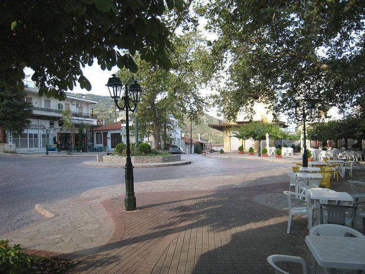
Notable sights are also the "Kakogianneio" Astronomical School and planetarium, the traditional water mill at the waterfall near the entrance of the town, and the martyrs' monument at the central town square, dedicated to the people executed by the Germans on 17 June 1944. Due to the proximity of Oeta, Ypati has also become a centre for excursions to the mountain, and is the starting point of several trekking paths.
The 15th-century Agathonos Monastery is located some 3 km west of the town. The monastery also houses the Oiti Natural History Museum, dedicated to the geology, climate, flora and fauna of Mount Oeta and its national park.