
- land 10.95 sq mi (28 km) - summer (DST) CDT (UTC-5) Population 9,944 (2013) | - water 0.0 sq mi (0 km), 0% | |
 | ||
Weather 24°C, Wind S at 11 km/h, 44% Humidity Mayor Ken Ritter; Chief administrative officer Simone B. Champagne; Police Chief Rickey Boudreaux | ||
Youngsville louisiana homes for sale 222 cedar grove
Youngsville is a small city in Lafayette Parish, Louisiana, United States. The population was 11,961 as of the 2015 Census Bureau estimates.[1] It is part of the Lafayette Metropolitan Statistical Area.
Contents
- Youngsville louisiana homes for sale 222 cedar grove
- Map of Youngsville LA USA
- Geography
- Background
- Public Schools
- Private Schools
- Subdivisions
- Infrastructure
- Demographics
- Louisiana Flood of 2016
- References
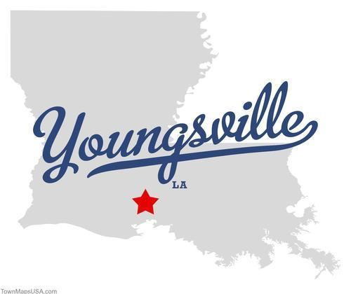
Map of Youngsville, LA, USA
Youngsville was the birthplace of the colorful Louisiana businessman and politician Dudley J. LeBlanc, the entrepreneur of the Hadacol fortune of the 1950s.
Bernard LeBas of Ville Platte, has represented Evangeline and St. Landry parishes in the Louisiana House of Representatives since 2008. He is a former resident of Youngsville.
Geography
Youngsville is located at 30°6′2″N 91°59′27″W (30.100595, -91.990707).
According to the United States Census Bureau, the city has a total land area of 10.95 square miles (28.36 km²).[2]
Background
Youngsville today still reflects its history in its people, culture, traditions, and architecture. It was settled in the early 19th century by French Acadian farmers. Prior to 1839, George Roy and his son, Desire, laid out the area and named the community "Royville." The settlement had grown by 1859 large enough to establish one of the oldest Catholic Churches in Lafayette Parish; St. Anne Catholic Church, and had named its oldest street, Church Street. In 1908, the United States Postal Service asked village leaders to change the name because the town was being confused with the north Louisiana town of Rayville. So in 1908, the Village of Youngsville was incorporated. The village was named "Youngsville," meaning young village, and incorporated. It chose a democratic government, an elected Mayor and three Aldermen, to govern its people.
The Village continued to develop and on January 20, 1983, Louisiana Governor David C. Treen declared the village a town. The town chose as its governing body, a Mayor and five Aldermen to accommodate its population.
Youngsville has been the fastest growing town in Louisiana from 1990 to 2005. Its population has increased by over 300 percent. According to the 2010 Census, Youngsville grew at a rate of 103% between year 2000 and 2010. Because of its growth, Youngsville was declared a city by then Governor Kathleen Blanco in 2006. From 2000 to 2007, the City of Youngsville was one of the fastest growing municipalities in the State of Louisiana. In 2007, Mayor Wilson Viator and the Youngsville City Council named Joey Langlinais as the Chairman of the Centennial Committee.
Although the city has extended its boundaries and expanded its services, Youngsville has remained a rural city surrounded by sugarcane farms which enjoy the unique atmosphere of an urban area of the City of Lafayette, Louisiana.[3]
Public Schools
Youngsville is part of the Lafayette Parish School System. The citizens of Youngsville are part of District 9 and currently are represented by Jeremy Hildalgo on the Lafayette Parish School Board.
The public elementary schools in Youngsville are Green T. Lindon Elementary School (located in downtown Youngsville) and Ernest Gallet Elementary School (located on Highway 92 between Chemin Metairie Parkway and Bonin Road). The Youngsville Middle School hosts students in fifth through eighth grades and is located at the corner of School Street and Church Street in downtown Youngsville. All public school students from Youngsville attend Ovey Comeaux High School in southern Lafayette.[4]
Private Schools
The private elementary school is Westminster Christian Academy (located on the outskirts of Youngsville). The private Kindergarten thru 12th grade school in Youngsville is Youngsville Christian School (located in downtown Youngsville). The private high school in Youngsville is Ascension Episcopal School located near the Sports Complex on Chemin Metaire Parkway across from Sugar Mill Pond.
Subdivisions
The sugarcane and soybean fields that once completely surrounded the town of Youngsville are becoming more difficult to find. Development began in the 1990s with the original Copperfield subdivision along Highway 89 near Fortune Road. The success of this subdivision led to continuous development throughout the most recent decades. The Copperfield subdivisions (Copperfield, Copperfield South, Copper Ridge, and Copper Meadows) have grown until the subdivisions abutted the original, old town of Youngsville along Iberia Street also known as Highway 92.
Many other subdivisions were also built in the former farmlands of Youngsville, including Field Crest, Oakthorn, and Sugar Mill Pond.
The creators of the River Ranch development in Lafayette have started a new mixed use planned community in Youngsville. Called Sugar Mill Pond, it will be home to over 2,000 housing units, a school, and town center with commercial establishments.
A list of all subdivisions in Youngsville, Louisiana: •Acadiana Cove •Anslem Ridge •Autumn Run •Beacon Hills Village •Beau Jardin •Beau Parterre •Beau Pre •Bicentennial Acres •Broussard Ulysse Estate •Caffery Glen •Cajun Country Mobile Home Park •Cane Village •Carmelite Estates •Carriage Lakes •Cedar Hills •Chelsi Meadow Estates •Chemet Park •Copper Meadows •Copperfield •Copperfield Estates •Copperfield South •Country Meadows •Country Village •Countryview •Crystal Cove •Cypress Cove •Cypress Gardens •Darphin Estates •El-Aire Park •Ella Trace •Fairfax Farms •Fairway Village •Field Crest Estates •Five K's Hideaway •Flanders Garden •Fleur De Lis Estates •Fortune Estates •Fortune Hills •Garden Heights •Gideon Grove •Grandview Terrace •Guillot Village •Hartford Farms •Heartland Estates •Highland Meadows •Highland Ridge •Holiday Hills •Hunter's Ridge •Jolie Village •Laurel Grove •Legacy Estates •Legend Creek •Longpointe •Milton Ridge Estates •Parkwood Townhouses •Pinnacle Place •Psalm Gardens •Royal Vista Mobile Home Park •Sabal Palms •Shady Pines •South Fork •Southlake Plantation •Sugar Mill Pond •Sugar Ridge •Sugarland Estates •Sunrise Mobile Home Park •Thornhill Heights •Twin Lakes Estates •Vermilion Village •Village At Copperfield •Village At Copperwood •Villas At Highland Plantation •Wells Landing •Willow Creek •Willowcreek •Wiltz Estate •Windermere •Windy Meadow •Woodcrest Youngsville •Woodland Estates
Infrastructure
The City of Youngsville began construction of the Chemin Metairie Parkway Project in the spring of 2007 to improve the roads in and around Youngsville. The first segment, from the intersection of Highway 92 and Chemin Metairie, to central Youngsville, opened in early 2009. Originally called the Youngsville Parkway, the road was renamed to avoid confusion with the existing Youngsville Highway also known as Highway 89. When the Parkway is complete, it will join Highway 90 near the Baker Hughes Complex in Broussard. A section of the project passes through the Sugar Mill Pond development and a new shopping complex anchored by Lafayette Parish's first Rouse's Grocery Store.[5]
In recent years, Youngsville has become known for its roundabouts. It was the first community within Lafayette Parish to embrace the usage of traffic circles to ease the congestion of the city's rising population. Youngsville now boasts at least 10 roundabouts at the following intersections:
- Highway 92 and Verot School Road
- Highway 92 and Chemin Metairie Parkway
- Highway 92 and Bonin Road
- Highway 92 and Highway 89
- Highway 89 and Chemin Metairie Parkway
- Fortune Road and Bonin Road
- Copper Meadow Boulevard and Fountain View Drive
- Prescott Boulevard and Broyles Lane
- Desbrook Lane and Annaberg Drive
- Viaulet Road and Chemin Metairie Parkway
The citizens of Youngsville voted in favor of a multi million-dollar, 70-acre sports complex along Chemin Metairie Parkway near Savoy Road. Construction to this complex will begin in 2012.
Demographics
As of the census of 2010, there were 8,105 people and 2,769 households residing in the town. The population density was 740 people per square mile (230.7/km²). There were 3,043 housing units at an average density of 225.5 per square mile (87.1/km²). The racial makeup of the town was 89.80% White, 6.8% African American, 0.4% Native American, 1.1% Asian, 0.25% Pacific Islander, 0.50% from other races, and 1.1% from two or more races. Hispanic or Latino of any race were 2.9% of the population.
There were 2,769 households out of which 47.8% had children under the age of 18 living with them, 63.4% were married couples living together, 11.0% had a female householder with no husband present, and 21.4% were non-families. 16.5% of all households were made up of individuals and 4.3% had someone living alone who was 65 years of age or older. The average household size was 2.92 and the average family size was 3.24.
In the town the population was spread out with 32.1% under the age of 18, 7.7% from 18 to 24, 37.3% from 25 to 44, 16.6% from 45 to 64, and 6.2% who were 65 years of age or older. The median age was 32 years. For every 100 females there were 102.1 males. For every 100 females age 18 and over, there were 96.6 males.
The median income for a household in the town was $67,147. Males had a median income of $41,700 versus $30,710 for females. The per capita income for the town was $31,257. About 4.5% of the population were below the poverty line.
Youngsville has the highest per capita income ($31,257) in Lafayette Parish. Compare that to the Parish's largest city Lafayette ($27,532) or the Parish as a whole ($26,791). Go a bit further and compare it to the state's largest cities like New Orleans ($24,929) or Baton Rouge ($23,195) or compare it to the entire state ($23,094). However, it is lower than the per capita income of Oak Hills Place, which at $65,938 is significantly higher. Ruston, at $34,329 per capita, is also higher.
Louisiana Flood of 2016
On the morning of Friday, August 12, 2016 rain began to fall over Youngsville, Louisiana as well as much of the south central part of the state, in what is now being considered to be the states worst flood disaster by rainfall on record, in some areas.
The Louisiana Flood of 2016 was triggered by a complicated, slow-moving low-pressure weather system that dumped as much as two feet of rain on several parishes in 48 hours. The record two-day rainfall in some areas had a 0.1 percent chance of occurring in any year, the equivalent of a "1,000-year rain", according to the Lower Mississippi River Forecast Center, based at the Slidell office of the National Weather Service.
In the two-day period ending Saturday at 8 p.m., several areas also saw rainfall amounts equaling a 1 percent chance of occurring in any year, a so-called 100-year event.
The Red Cross is calling this "The worst natural disaster since Hurricane Sandy."