
Length 71 mi (114 km) Hazards Severe Weather Surface Crushed limestone | Use Hiking, Biking Designation National Scenic Trail Trailheads Confluence, McKeesport | |
 | ||
Location Allegheny / Fayette / Westland counties, Pennsylvania, USA | ||
Youghiogheny river trail adventure
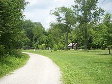
The Yough River Trail is a non-motorized multi-use rail trail that stretches 71 miles (114 km) between McKeesport and Confluence, Pennsylvania. It is part of the Great Allegheny Passage that allows cyclists to bike from Pittsburgh to Washington, D.C. The north section of the trail runs 43 miles (69 km) between McKeesport and Connellsville, Pennsylvania, and the south section runs 28 miles (45 km) between Connellsville and Confluence.
Contents
- Youghiogheny river trail adventure
- Map of Youghiogheny River Trail Pennsylvania USA
- Youghiogheny river trail ride
- Access areas
- Overnight use
- References
Map of Youghiogheny River Trail, Pennsylvania, USA
It is named after and runs along the Youghiogheny River. The trail surface is composed of crushed limestone.
Along the trail are scenic points and fishing opportunities. The route forms a part of BicyclePA Route S.
Youghiogheny river trail ride
Access areas
There are 9 access areas on the Yough River Trail, all are free of charge; only the Cedar Creek Access Area offers secure overnight parking.
Overnight use
Overnight use on the YRT is restricted to designated campgrounds, these are free-of-charge and can be only one (1) night. All designated campgrounds are equipped with a sanitary toilet (SST), fire grates, and designated tent pads.
Camping Areas are as follows: