
Type Street South end Druitt Street | Length 1 km (0.6 mi) | |
 | ||
North end Grosvenor Street / Bradfield Highway | ||
York street sydney timelapse
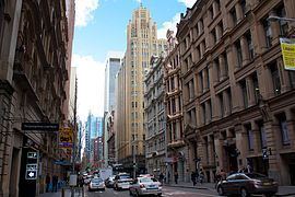
York Street is a street in the central business district of Sydney in New South Wales, Australia. York Street runs 1 kilometre (0.62 mi) in a north to south direction only and is used predominantly by buses from northern districts of Sydney.
Contents
- York street sydney timelapse
- Map of York St Sydney NSW 2000 Australia
- Route
- Points of interest
- References
Map of York St, Sydney NSW 2000, Australia
Route
From its northern terminus at the junction of Grosvenor Street with the Bradfield Highway, York Street runs south past Wynyard railway station, with major intersections at King and Market streets. The southern terminus of York Street is at Druitt Street, adjacent to the Sydney Town Hall and the Queen Victoria Building. Between Market Street and Druitt Street, traffic is restricted to buses, bicycles and service vehicles only.
Two lines of the T1 North Shore, Northern & Western Line run under York Street.
Points of interest
References
York Street, Sydney Wikipedia(Text) CC BY-SA