
OS grid reference SJ399101 Local time Sunday 6:34 AM | Unitary authority Sovereign state United Kingdom Dialling code 01743 | |
 | ||
Weather 9°C, Wind S at 10 km/h, 76% Humidity | ||
Yockleton is a village in Shropshire, England.
Map of Yockleton, Shrewsbury, UK
Yockleton is west of the county town of Shrewsbury, on the B4386 road to Montgomery and near the River Severn. The population as taken at the 2011 census can be found under Condover
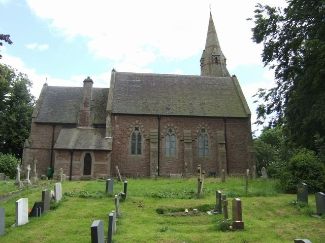
There is one local pub, the Yockleton Arms (formerly the Pink Elephant), several miles west on the B4386, a 19th-century village church (C of E), and a village hall, as well as an old people's home in the old Vicarage.
Previously Yockleton had a school, a garage, a post office and a pub in the heart of the village. These have closed as the village has developed into a commuter village for Shrewsbury. There is a Motte and Bailey in a field not far from the church.
Yockleton is near to Ford and Westbury, and lies in the Westbury civil parish; the hamlets of Edge and Farley lie due south of the village, and Nox is to the east.