
Time zone China Standard (UTC+8) | ||
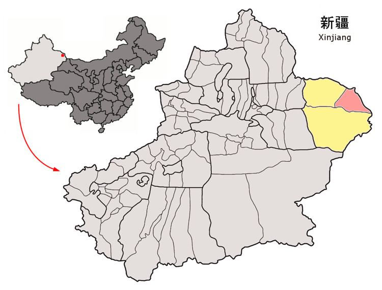 | ||
Prefecture-level divisions Hami City, Hami Prefecture | ||
Yiwu (Aratürük) County (Uyghur: ئارا تۈرۈك ناھىيىسى, Ара Түрүк Наһийиси, ULY: Ara Türük Nahiyisi, UYY: Ara Türük Nah̡iyisi?; Chinese: 伊吾县; pinyin: Yīwú Xiàn) is a county within the Xinjiang Uyghur Autonomous Region and is under the administration of the Hami Prefecture. It contains an area of 19,511 km2. According to the 2002 census, it has a population of 20,000.
Contents
Map of Yiwu, Kumul, Xinjiang, China
Geography
The Yiwu County is located in the northeastern part of the prefecture, between the Qarliq Shan mountain range (along which it borders on Hami City) and the Mongolian border. Outside of the mountain range, most of the county is within the Gobi Desert.
Some of the county important populated places are located in the oases irrigated by the intermittent Yiwu River, which flows north from the mountains, eventually disappearing in the desert. These include, from south to north, Yiwu Town (伊吾镇, the county seat), Weizi Xia Township (苇子峡乡), and Laomao Hu Town (淖毛湖镇).
As of the 1920s, the area of today's Yiwu town was referred to as "Tuhulu" (吐葫芦), and that name is still retained by the Tuhulu Township (吐葫芦乡) adjacent to today's Yiwu town. At the time, it was the first place with an actual river and some agriculture that weary travellers from the east would reach after crossing several hundreds of kilometers of desert (since crossing Edsin Gol, a River in Inner Mongolia).
Other places in the county include Qianshan Kazakh Township (前山哈萨克族乡), Yanchi township (盐池乡), and Xiamaya Township (下马崖乡).